S14A Cedar City, UT, USA - Earthquake Result Viewer
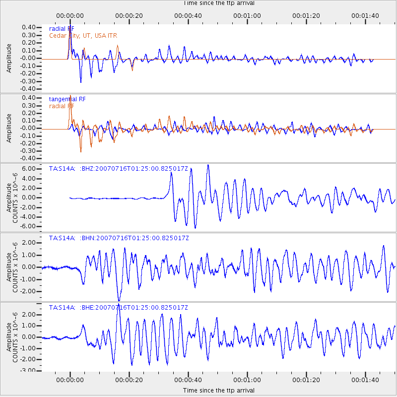
Earthquake location: Near West Coast Of Honshu, Japan
Earthquake latitude/longitude: 37.5/138.4
Earthquake time(UTC): 2007/07/16 (197) 01:13:22 GMT
Earthquake Depth: 12 km
Earthquake Magnitude: 6.5 MB, 6.4 MS, 6.6 MW, 6.5 MW
Earthquake Catalog/Contributor: WHDF/NEIC
Network: TA USArray Transportable Network (new EarthScope stations)
Station: S14A Cedar City, UT, USA
Lat/Lon: 37.76 N/113.17 W
Elevation: 1746 m
Distance: 80.1 deg
Az: 49.763 deg
Baz: 310.032 deg
Ray Param: 0.048475467
Estimated Moho Depth: 14.5 km
Estimated Crust Vp/Vs: 1.61
Assumed Crust Vp: 6.194 km/s
Estimated Crust Vs: 3.859 km/s
Estimated Crust Poisson's Ratio: 0.18
Radial Match: 92.89286 %
Radial Bump: 400
Transverse Match: 73.3862 %
Transverse Bump: 400
SOD ConfigId: 2564
Insert Time: 2010-03-07 03:19:46.955 +0000
GWidth: 2.5
Max Bumps: 400
Tol: 0.001

Signal To Noise

ChannelStoNSTALTA
TA:S14A: :BHN:20070716T01:25:00.825017Z8.8666435.2260594E-75.8940675E-8
TA:S14A: :BHE:20070716T01:25:00.825017Z6.0865774.1959365E-76.893754E-8
TA:S14A: :BHZ:20070716T01:25:00.825017Z27.142191.958174E-67.214502E-8
Arrivals
Ps1.5 SECOND
PpPs5.9 SECOND
PsPs/PpSs7.4 SECOND