J05A Fort Rock, OR, USA - Earthquake Result Viewer
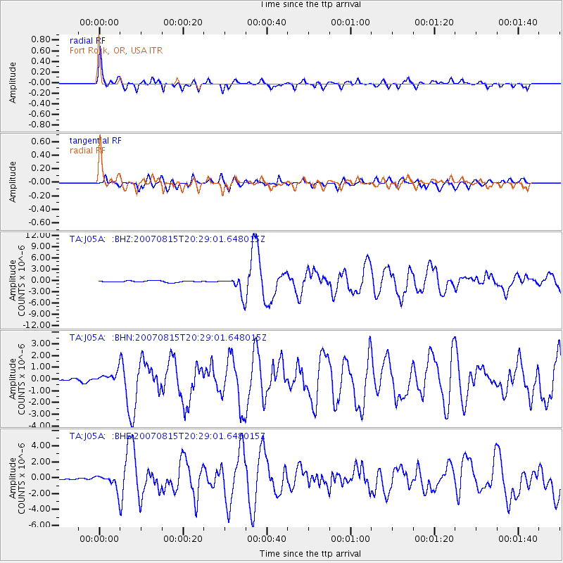
Earthquake location: Andreanof Islands, Aleutian Is.
Earthquake latitude/longitude: 50.3/-177.5
Earthquake time(UTC): 2007/08/15 (227) 20:22:11 GMT
Earthquake Depth: 9.0 km
Earthquake Magnitude: 6.3 MB, 6.2 MS, 6.4 MW, 5.9 ML
Earthquake Catalog/Contributor: WHDF/NEIC
Network: TA USArray Transportable Network (new EarthScope stations)
Station: J05A Fort Rock, OR, USA
Lat/Lon: 43.28 N/121.24 W
Elevation: 1540 m
Distance: 38.4 deg
Az: 78.191 deg
Baz: 300.772 deg
Ray Param: 0.07560261
Estimated Moho Depth: 59.25 km
Estimated Crust Vp/Vs: 1.72
Assumed Crust Vp: 6.597 km/s
Estimated Crust Vs: 3.83 km/s
Estimated Crust Poisson's Ratio: 0.25
Radial Match: 81.229836 %
Radial Bump: 400
Transverse Match: 79.24788 %
Transverse Bump: 400
SOD ConfigId: 2564
Insert Time: 2010-03-07 03:33:31.560 +0000
GWidth: 2.5
Max Bumps: 400
Tol: 0.001

Signal To Noise

ChannelStoNSTALTA
TA:J05A: :BHN:20070815T20:29:01.648015Z2.22920235.0526836E-72.2665881E-7
TA:J05A: :BHE:20070815T20:29:01.648015Z4.3985471.003323E-62.2810327E-7
TA:J05A: :BHZ:20070815T20:29:01.648015Z14.0914482.6300493E-61.8664153E-7
Arrivals
Ps7.0 SECOND
PpPs23 SECOND
PsPs/PpSs30 SECOND