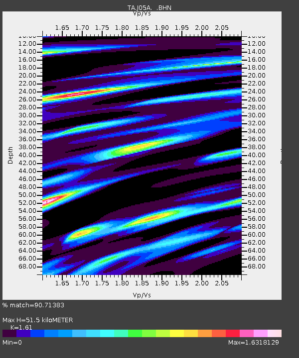
J05A Fort Rock, OR, USA - Earthquake Result Viewer
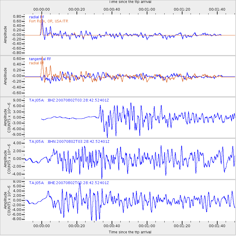
Earthquake location: Andreanof Islands, Aleutian Is.
Earthquake latitude/longitude: 51.3/-180.0
Earthquake time(UTC): 2007/08/02 (214) 03:21:42 GMT
Earthquake Depth: 21 km
Earthquake Magnitude: 6.3 MB, 6.6 MS, 6.7 MW, 6.6 MW
Earthquake Catalog/Contributor: WHDF/NEIC
Network: TA USArray Transportable Network (new EarthScope stations)
Station: J05A Fort Rock, OR, USA
Lat/Lon: 43.28 N/121.24 W
Elevation: 1540 m
Distance: 39.7 deg
Az: 77.902 deg
Baz: 302.81 deg
Ray Param: 0.07482166
Estimated Moho Depth: 51.5 km
Estimated Crust Vp/Vs: 1.61
Assumed Crust Vp: 6.597 km/s
Estimated Crust Vs: 4.098 km/s
Estimated Crust Poisson's Ratio: 0.19
Radial Match: 90.71383 %
Radial Bump: 400
Transverse Match: 85.22507 %
Transverse Bump: 400
SOD ConfigId: 2564
Insert Time: 2010-03-07 03:33:34.116 +0000
GWidth: 2.5
Max Bumps: 400
Tol: 0.001

Signal To Noise

ChannelStoNSTALTA
TA:J05A: :BHN:20070802T03:28:42.52401Z1.07037094.177687E-73.9030272E-7
TA:J05A: :BHE:20070802T03:28:42.52401Z3.5899281.8324486E-65.104416E-7
TA:J05A: :BHZ:20070802T03:28:42.52401Z5.91014862.3483772E-63.9734653E-7
Arrivals
Ps5.2 SECOND
PpPs19 SECOND
PsPs/PpSs24 SECOND