G05A Wamic, OR, USA - Earthquake Result Viewer
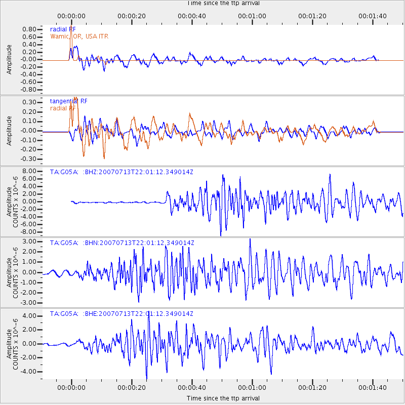
Earthquake location: Andreanof Islands, Aleutian Is.
Earthquake latitude/longitude: 51.8/-176.3
Earthquake time(UTC): 2007/07/13 (194) 21:54:43 GMT
Earthquake Depth: 35 km
Earthquake Magnitude: 5.7 MB, 5.6 MS, 6.0 MW, 5.9 MW
Earthquake Catalog/Contributor: WHDF/NEIC
Network: TA USArray Transportable Network (new EarthScope stations)
Station: G05A Wamic, OR, USA
Lat/Lon: 45.24 N/121.32 W
Elevation: 594 m
Distance: 36.2 deg
Az: 78.184 deg
Baz: 300.728 deg
Ray Param: 0.0767283
Estimated Moho Depth: 24.0 km
Estimated Crust Vp/Vs: 1.60
Assumed Crust Vp: 6.597 km/s
Estimated Crust Vs: 4.123 km/s
Estimated Crust Poisson's Ratio: 0.18
Radial Match: 80.53255 %
Radial Bump: 400
Transverse Match: 66.94605 %
Transverse Bump: 400
SOD ConfigId: 2564
Insert Time: 2010-03-07 03:34:23.127 +0000
GWidth: 2.5
Max Bumps: 400
Tol: 0.001

Signal To Noise

ChannelStoNSTALTA
TA:G05A: :BHN:20070713T22:01:12.349014Z2.00234322.886281E-71.4414516E-7
TA:G05A: :BHE:20070713T22:01:12.349014Z2.09018373.638236E-71.7406298E-7
TA:G05A: :BHZ:20070713T22:01:12.349014Z13.7826251.4344761E-61.0407858E-7
Arrivals
Ps2.4 SECOND
PpPs8.7 SECOND
PsPs/PpSs11 SECOND