
S11A Rachel, NV, USA - Earthquake Result Viewer
| ||||||||||||||||||
| ||||||||||||||||||
| ||||||||||||||||||
|
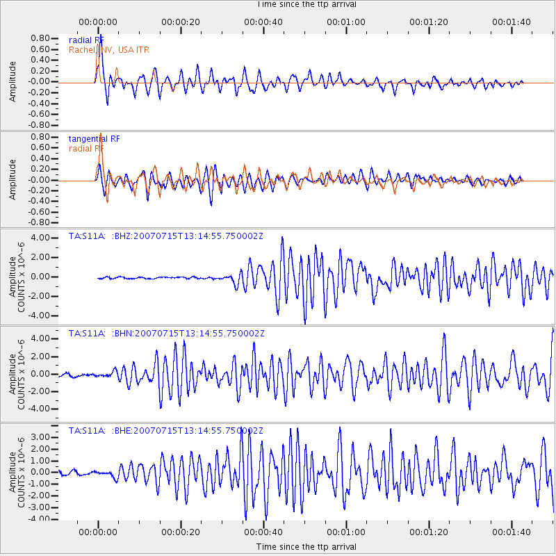
Signal To Noise
| Channel | StoN | STA | LTA |
| TA:S11A: :BHN:20070715T13:14:55.750002Z | 2.4241047 | 3.2767636E-7 | 1.3517418E-7 |
| TA:S11A: :BHE:20070715T13:14:55.750002Z | 1.962759 | 3.0376646E-7 | 1.5476503E-7 |
| TA:S11A: :BHZ:20070715T13:14:55.750002Z | 6.904811 | 5.276228E-7 | 7.64138E-8 |
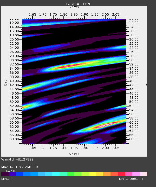
| Arrivals | |
| Ps | 10 SECOND |
| PpPs | 27 SECOND |
| PsPs/PpSs | 38 SECOND |

