
I11A Placerville, ID, USA - Earthquake Result Viewer
| ||||||||||||||||||
| ||||||||||||||||||
| ||||||||||||||||||
|
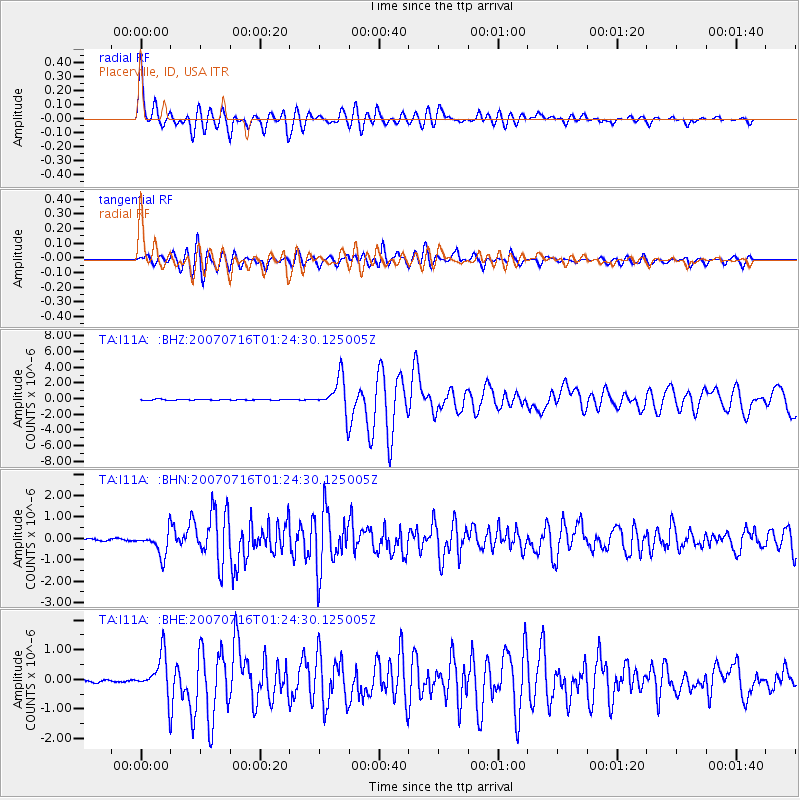
Signal To Noise
| Channel | StoN | STA | LTA |
| TA:I11A: :BHN:20070716T01:24:30.125005Z | 11.748658 | 5.6847244E-7 | 4.838616E-8 |
| TA:I11A: :BHE:20070716T01:24:30.125005Z | 14.401678 | 6.6860974E-7 | 4.6425818E-8 |
| TA:I11A: :BHZ:20070716T01:24:30.125005Z | 37.677715 | 2.240009E-6 | 5.945183E-8 |
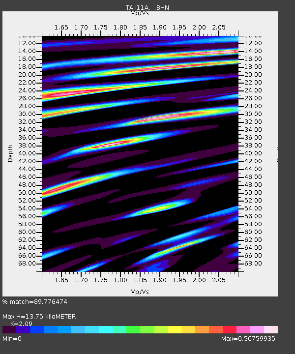
| Arrivals | |
| Ps | 2.4 SECOND |
| PpPs | 6.6 SECOND |
| PsPs/PpSs | 9.0 SECOND |

