I11A Placerville, ID, USA - Earthquake Result Viewer
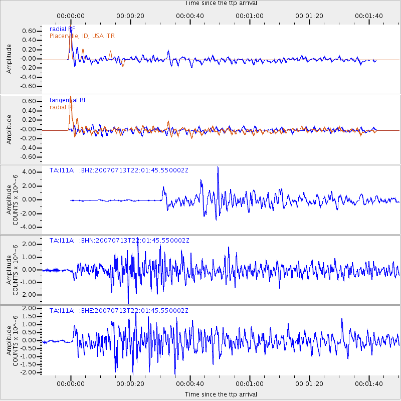
Earthquake location: Andreanof Islands, Aleutian Is.
Earthquake latitude/longitude: 51.8/-176.3
Earthquake time(UTC): 2007/07/13 (194) 21:54:43 GMT
Earthquake Depth: 35 km
Earthquake Magnitude: 5.7 MB, 5.6 MS, 6.0 MW, 5.9 MW
Earthquake Catalog/Contributor: WHDF/NEIC
Network: TA USArray Transportable Network (new EarthScope stations)
Station: I11A Placerville, ID, USA
Lat/Lon: 43.91 N/115.96 W
Elevation: 1288 m
Distance: 40.2 deg
Az: 76.722 deg
Baz: 303.328 deg
Ray Param: 0.07447818
Estimated Moho Depth: 11.25 km
Estimated Crust Vp/Vs: 2.10
Assumed Crust Vp: 6.291 km/s
Estimated Crust Vs: 2.999 km/s
Estimated Crust Poisson's Ratio: 0.35
Radial Match: 89.89108 %
Radial Bump: 400
Transverse Match: 81.66072 %
Transverse Bump: 400
SOD ConfigId: 2564
Insert Time: 2010-03-07 03:59:02.324 +0000
GWidth: 2.5
Max Bumps: 400
Tol: 0.001

Signal To Noise

ChannelStoNSTALTA
TA:I11A: :BHN:20070713T22:01:45.550002Z4.1076173.159961E-77.6929304E-8
TA:I11A: :BHE:20070713T22:01:45.550002Z11.1705044.6378497E-74.1518717E-8
TA:I11A: :BHZ:20070713T22:01:45.550002Z14.8542358.086751E-75.4440715E-8
Arrivals
Ps2.1 SECOND
PpPs5.2 SECOND
PsPs/PpSs7.3 SECOND