I10A Payette, ID, USA - Earthquake Result Viewer
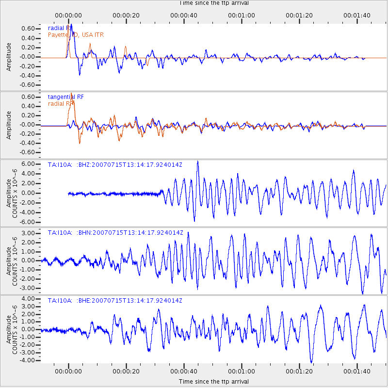
Earthquake location: Fox Islands, Aleutian Islands
Earthquake latitude/longitude: 52.5/-168.0
Earthquake time(UTC): 2007/07/15 (196) 13:08:00 GMT
Earthquake Depth: 10 km
Earthquake Magnitude: 5.8 MB, 5.9 MS, 6.1 MW, 6.0 MW
Earthquake Catalog/Contributor: WHDF/NEIC
Network: TA USArray Transportable Network (new EarthScope stations)
Station: I10A Payette, ID, USA
Lat/Lon: 44.09 N/116.80 W
Elevation: 782 m
Distance: 34.5 deg
Az: 83.185 deg
Baz: 302.569 deg
Ray Param: 0.07772574
Estimated Moho Depth: 22.75 km
Estimated Crust Vp/Vs: 1.60
Assumed Crust Vp: 6.571 km/s
Estimated Crust Vs: 4.107 km/s
Estimated Crust Poisson's Ratio: 0.18
Radial Match: 89.672005 %
Radial Bump: 351
Transverse Match: 70.73841 %
Transverse Bump: 400
SOD ConfigId: 2564
Insert Time: 2010-03-07 04:01:21.665 +0000
GWidth: 2.5
Max Bumps: 400
Tol: 0.001

Signal To Noise

ChannelStoNSTALTA
TA:I10A: :BHN:20070715T13:14:17.924014Z1.0272942.4943986E-72.4281255E-7
TA:I10A: :BHE:20070715T13:14:17.924014Z0.80777881.8529214E-72.2938474E-7
TA:I10A: :BHZ:20070715T13:14:17.924014Z5.0391636.7007676E-71.3297381E-7
Arrivals
Ps2.3 SECOND
PpPs8.2 SECOND
PsPs/PpSs10 SECOND