I10A Payette, ID, USA - Earthquake Result Viewer
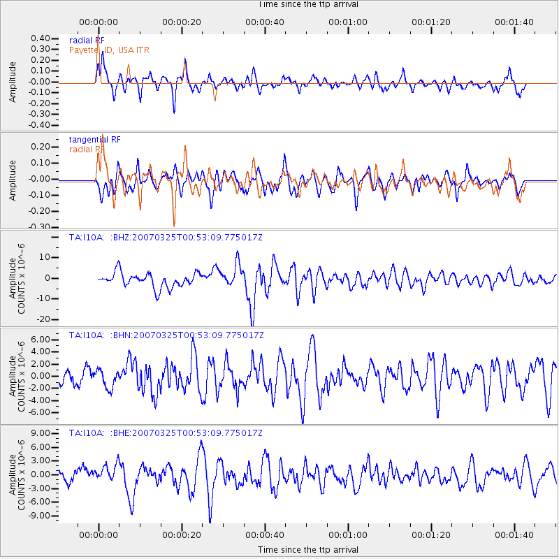
Earthquake location: Near West Coast Of Honshu, Japan
Earthquake latitude/longitude: 37.3/136.6
Earthquake time(UTC): 2007/03/25 (084) 00:41:57 GMT
Earthquake Depth: 8.0 km
Earthquake Magnitude: 6.1 MB, 6.8 MS, 6.7 MW, 6.6 MW
Earthquake Catalog/Contributor: WHDF/NEIC
Network: TA USArray Transportable Network (new EarthScope stations)
Station: I10A Payette, ID, USA
Lat/Lon: 44.09 N/116.80 W
Elevation: 782 m
Distance: 75.3 deg
Az: 45.568 deg
Baz: 307.832 deg
Ray Param: 0.05179606
Estimated Moho Depth: 13.75 km
Estimated Crust Vp/Vs: 1.60
Assumed Crust Vp: 6.571 km/s
Estimated Crust Vs: 4.107 km/s
Estimated Crust Poisson's Ratio: 0.18
Radial Match: 80.4624 %
Radial Bump: 400
Transverse Match: 64.979965 %
Transverse Bump: 400
SOD ConfigId: 2564
Insert Time: 2010-03-07 04:01:29.334 +0000
GWidth: 2.5
Max Bumps: 400
Tol: 0.001

Signal To Noise

ChannelStoNSTALTA
TA:I10A: :BHN:20070325T00:53:09.775017Z1.55614041.4945933E-69.604489E-7
TA:I10A: :BHE:20070325T00:53:09.775017Z1.36710462.0231041E-61.4798459E-6
TA:I10A: :BHZ:20070325T00:53:09.775017Z1.59057165.538426E-63.482035E-6
Arrivals
Ps1.3 SECOND
PpPs5.2 SECOND
PsPs/PpSs6.5 SECOND