You are here: Home > Network List > IC - New China Digital Seismograph Network Stations List
> Station HIA Hailar, Neimenggu Autonomous Region, China > Earthquake Result Viewer
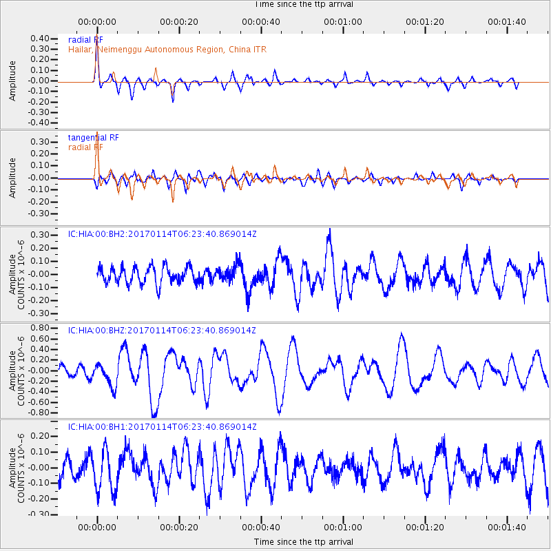
HIA Hailar, Neimenggu Autonomous Region, China - Earthquake Result Viewer
*The percent match for this event was below the threshold and hence no stack was calculated.
| Earthquake location: |
Fiji Islands Region |
| Earthquake latitude/longitude: |
-18.6/176.2 |
| Earthquake time(UTC): |
2017/01/14 (014) 06:11:41 GMT |
| Earthquake Depth: |
10 km |
| Earthquake Magnitude: |
6.1 Mwp |
| Earthquake Catalog/Contributor: |
NEIC PDE/us |
|
| Network: |
IC New China Digital Seismograph Network |
| Station: |
HIA Hailar, Neimenggu Autonomous Region, China |
| Lat/Lon: |
49.27 N/119.74 E |
| Elevation: |
620 m |
|
| Distance: |
84.1 deg |
| Az: |
326.696 deg |
| Baz: |
127.336 deg |
| Ray Param: |
$rayparam |
*The percent match for this event was below the threshold and hence was not used in the summary stack. |
|
| Radial Match: |
72.604645 % |
| Radial Bump: |
380 |
| Transverse Match: |
61.053947 % |
| Transverse Bump: |
400 |
| SOD ConfigId: |
1943534 |
| Insert Time: |
2017-01-28 06:12:53.744 +0000 |
| GWidth: |
2.5 |
| Max Bumps: |
400 |
| Tol: |
0.001 |
|
Signal To Noise
| Channel | StoN | STA | LTA |
| IC:HIA:00:BHZ:20170114T06:23:40.869014Z | 2.9690151 | 2.1321904E-7 | 7.181474E-8 |
| IC:HIA:00:BH1:20170114T06:23:40.869014Z | 2.5204363 | 1.3508115E-7 | 5.3594356E-8 |
| IC:HIA:00:BH2:20170114T06:23:40.869014Z | 0.97519547 | 6.114685E-8 | 6.270214E-8 |
| Arrivals |
| Ps | |
| PpPs | |
| PsPs/PpSs | |


