You are here: Home > Network List > IC - New China Digital Seismograph Network Stations List
> Station HIA Hailar, Neimenggu Autonomous Region, China > Earthquake Result Viewer
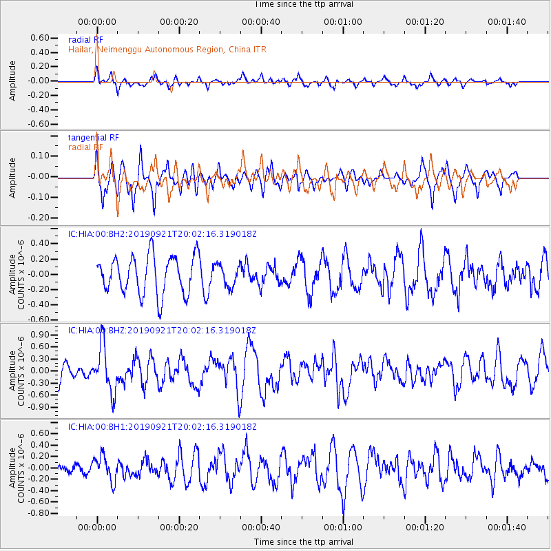
HIA Hailar, Neimenggu Autonomous Region, China - Earthquake Result Viewer
*The percent match for this event was below the threshold and hence no stack was calculated.
| Earthquake location: |
Banda Sea |
| Earthquake latitude/longitude: |
-6.5/130.4 |
| Earthquake time(UTC): |
2019/09/21 (264) 19:53:10 GMT |
| Earthquake Depth: |
48 km |
| Earthquake Magnitude: |
5.9 Mww |
| Earthquake Catalog/Contributor: |
NEIC PDE/us |
|
| Network: |
IC New China Digital Seismograph Network |
| Station: |
HIA Hailar, Neimenggu Autonomous Region, China |
| Lat/Lon: |
49.27 N/119.74 E |
| Elevation: |
620 m |
|
| Distance: |
56.3 deg |
| Az: |
351.594 deg |
| Baz: |
167.187 deg |
| Ray Param: |
$rayparam |
*The percent match for this event was below the threshold and hence was not used in the summary stack. |
|
| Radial Match: |
54.68696 % |
| Radial Bump: |
400 |
| Transverse Match: |
55.421303 % |
| Transverse Bump: |
400 |
| SOD ConfigId: |
19053131 |
| Insert Time: |
2019-10-05 19:58:47.744 +0000 |
| GWidth: |
2.5 |
| Max Bumps: |
400 |
| Tol: |
0.001 |
|
Signal To Noise
| Channel | StoN | STA | LTA |
| IC:HIA:00:BHZ:20190921T20:02:16.319018Z | 2.7961664 | 6.0123693E-7 | 2.1502188E-7 |
| IC:HIA:00:BH1:20190921T20:02:16.319018Z | 1.4026847 | 2.2516828E-7 | 1.6052665E-7 |
| IC:HIA:00:BH2:20190921T20:02:16.319018Z | 0.5672396 | 1.4162677E-7 | 2.4967716E-7 |
| Arrivals |
| Ps | |
| PpPs | |
| PsPs/PpSs | |


