A10A Northport, WA, USA - Earthquake Result Viewer
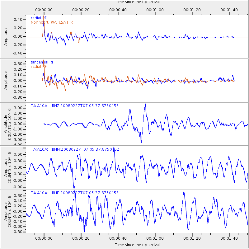
Earthquake location: Bonin Islands, Japan Region
Earthquake latitude/longitude: 26.8/142.4
Earthquake time(UTC): 2008/02/27 (058) 06:54:20 GMT
Earthquake Depth: 15 km
Earthquake Magnitude: 5.8 MB, 6.1 MS, 6.2 MW, 6.2 MW
Earthquake Catalog/Contributor: WHDF/NEIC
Network: TA USArray Transportable Network (new EarthScope stations)
Station: A10A Northport, WA, USA
Lat/Lon: 48.98 N/117.56 W
Elevation: 688 m
Distance: 76.4 deg
Az: 41.877 deg
Baz: 295.108 deg
Ray Param: 0.051016662
Estimated Moho Depth: 23.25 km
Estimated Crust Vp/Vs: 1.69
Assumed Crust Vp: 6.571 km/s
Estimated Crust Vs: 3.888 km/s
Estimated Crust Poisson's Ratio: 0.23
Radial Match: 81.121315 %
Radial Bump: 400
Transverse Match: 62.134068 %
Transverse Bump: 397
SOD ConfigId: 2564
Insert Time: 2010-03-07 04:41:21.883 +0000
GWidth: 2.5
Max Bumps: 400
Tol: 0.001

Signal To Noise

ChannelStoNSTALTA
TA:A10A: :BHN:20080227T07:05:37.875015Z1.2629282.4644262E-71.9513593E-7
TA:A10A: :BHE:20080227T07:05:37.875015Z1.24512022.1859238E-71.7555926E-7
TA:A10A: :BHZ:20080227T07:05:37.875015Z2.02985955.396246E-72.658433E-7
Arrivals
Ps2.5 SECOND
PpPs9.2 SECOND
PsPs/PpSs12 SECOND