A10A Northport, WA, USA - Earthquake Result Viewer
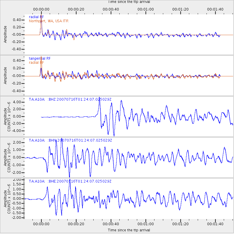
Earthquake location: Near West Coast Of Honshu, Japan
Earthquake latitude/longitude: 37.5/138.4
Earthquake time(UTC): 2007/07/16 (197) 01:13:22 GMT
Earthquake Depth: 12 km
Earthquake Magnitude: 6.5 MB, 6.4 MS, 6.6 MW, 6.5 MW
Earthquake Catalog/Contributor: WHDF/NEIC
Network: TA USArray Transportable Network (new EarthScope stations)
Station: A10A Northport, WA, USA
Lat/Lon: 48.98 N/117.56 W
Elevation: 688 m
Distance: 70.7 deg
Az: 42.62 deg
Baz: 305.209 deg
Ray Param: 0.054774247
Estimated Moho Depth: 36.75 km
Estimated Crust Vp/Vs: 1.68
Assumed Crust Vp: 6.571 km/s
Estimated Crust Vs: 3.917 km/s
Estimated Crust Poisson's Ratio: 0.22
Radial Match: 89.36287 %
Radial Bump: 400
Transverse Match: 90.0952 %
Transverse Bump: 400
SOD ConfigId: 2564
Insert Time: 2010-03-07 04:41:58.910 +0000
GWidth: 2.5
Max Bumps: 400
Tol: 0.001

Signal To Noise

ChannelStoNSTALTA
TA:A10A: :BHN:20070716T01:24:07.025029Z22.0731687.676445E-73.477727E-8
TA:A10A: :BHE:20070716T01:24:07.025029Z10.9888044.877837E-74.4389157E-8
TA:A10A: :BHZ:20070716T01:24:07.025029Z40.657262.0081184E-64.9391385E-8
Arrivals
Ps3.9 SECOND
PpPs14 SECOND
PsPs/PpSs18 SECOND