
A10A Northport, WA, USA - Earthquake Result Viewer
| ||||||||||||||||||
| ||||||||||||||||||
| ||||||||||||||||||
|
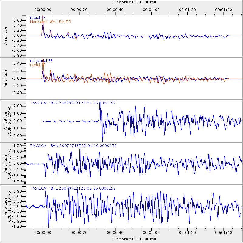
Signal To Noise
| Channel | StoN | STA | LTA |
| TA:A10A: :BHN:20070713T22:01:16.000015Z | 8.456228 | 4.3185992E-7 | 5.107004E-8 |
| TA:A10A: :BHE:20070713T22:01:16.000015Z | 9.690328 | 4.5916906E-7 | 4.7384265E-8 |
| TA:A10A: :BHZ:20070713T22:01:16.000015Z | 19.567286 | 1.1242724E-6 | 5.7456738E-8 |
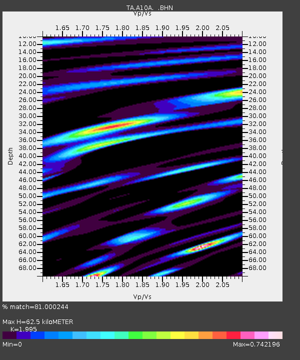
| Arrivals | |
| Ps | 10 SECOND |
| PpPs | 27 SECOND |
| PsPs/PpSs | 37 SECOND |

