A10A Northport, WA, USA - Earthquake Result Viewer
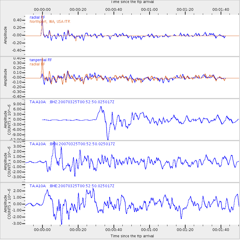
Earthquake location: Near West Coast Of Honshu, Japan
Earthquake latitude/longitude: 37.3/136.6
Earthquake time(UTC): 2007/03/25 (084) 00:41:57 GMT
Earthquake Depth: 8.0 km
Earthquake Magnitude: 6.1 MB, 6.8 MS, 6.7 MW, 6.6 MW
Earthquake Catalog/Contributor: WHDF/NEIC
Network: TA USArray Transportable Network (new EarthScope stations)
Station: A10A Northport, WA, USA
Lat/Lon: 48.98 N/117.56 W
Elevation: 688 m
Distance: 71.9 deg
Az: 41.82 deg
Baz: 306.225 deg
Ray Param: 0.054031674
Estimated Moho Depth: 37.0 km
Estimated Crust Vp/Vs: 1.68
Assumed Crust Vp: 6.571 km/s
Estimated Crust Vs: 3.905 km/s
Estimated Crust Poisson's Ratio: 0.23
Radial Match: 91.53794 %
Radial Bump: 400
Transverse Match: 80.28703 %
Transverse Bump: 400
SOD ConfigId: 2564
Insert Time: 2010-03-07 04:42:10.650 +0000
GWidth: 2.5
Max Bumps: 400
Tol: 0.001

Signal To Noise

ChannelStoNSTALTA
TA:A10A: :BHN:20070325T00:52:50.025017Z8.0614018.495448E-71.0538425E-7
TA:A10A: :BHE:20070325T00:52:50.025017Z8.5393611.264785E-61.4811238E-7
TA:A10A: :BHZ:20070325T00:52:50.025017Z32.0341384.5441147E-61.4185225E-7
Arrivals
Ps4.0 SECOND
PpPs15 SECOND
PsPs/PpSs19 SECOND