You are here: Home > Network List > IC - New China Digital Seismograph Network Stations List
> Station HIA Hailar, Neimenggu Autonomous Region, China > Earthquake Result Viewer
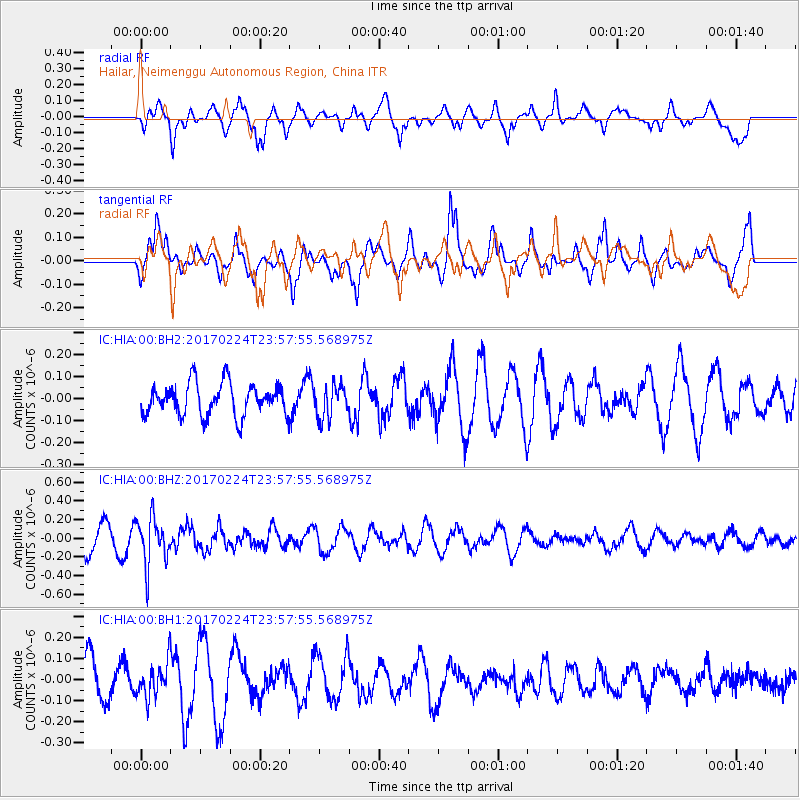
HIA Hailar, Neimenggu Autonomous Region, China - Earthquake Result Viewer
*The percent match for this event was below the threshold and hence no stack was calculated.
| Earthquake location: |
Fiji Islands Region |
| Earthquake latitude/longitude: |
-18.0/-178.5 |
| Earthquake time(UTC): |
2017/02/24 (055) 23:46:45 GMT |
| Earthquake Depth: |
581 km |
| Earthquake Magnitude: |
5.9 Mww |
| Earthquake Catalog/Contributor: |
NEIC PDE/us |
|
| Network: |
IC New China Digital Seismograph Network |
| Station: |
HIA Hailar, Neimenggu Autonomous Region, China |
| Lat/Lon: |
49.27 N/119.74 E |
| Elevation: |
620 m |
|
| Distance: |
86.4 deg |
| Az: |
324.66 deg |
| Baz: |
122.801 deg |
| Ray Param: |
$rayparam |
*The percent match for this event was below the threshold and hence was not used in the summary stack. |
|
| Radial Match: |
74.70937 % |
| Radial Bump: |
400 |
| Transverse Match: |
65.8907 % |
| Transverse Bump: |
400 |
| SOD ConfigId: |
1992691 |
| Insert Time: |
2017-03-10 23:48:51.980 +0000 |
| GWidth: |
2.5 |
| Max Bumps: |
400 |
| Tol: |
0.001 |
|
Signal To Noise
| Channel | StoN | STA | LTA |
| IC:HIA:00:BHZ:20170224T23:57:55.568975Z | 1.9053867 | 2.5422534E-7 | 1.3342454E-7 |
| IC:HIA:00:BH1:20170224T23:57:55.568975Z | 1.0110048 | 8.36644E-8 | 8.2753715E-8 |
| IC:HIA:00:BH2:20170224T23:57:55.568975Z | 1.0184133 | 7.412644E-8 | 7.2786214E-8 |
| Arrivals |
| Ps | |
| PpPs | |
| PsPs/PpSs | |


