You are here: Home > Network List > TA - USArray Transportable Network (new EarthScope stations) Stations List
> Station F26A Lodgepole, SD, USA > Earthquake Result Viewer
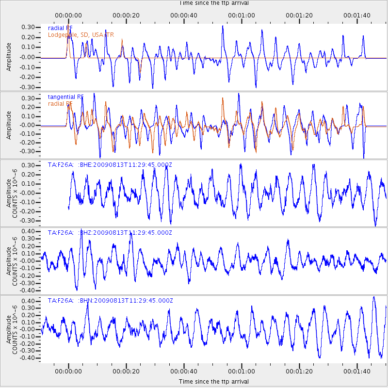
F26A Lodgepole, SD, USA - Earthquake Result Viewer
*The percent match for this event was below the threshold and hence no stack was calculated.
| Earthquake location: |
Tonga Islands |
| Earthquake latitude/longitude: |
-21.7/-174.6 |
| Earthquake time(UTC): |
2009/08/13 (225) 11:17:01 GMT |
| Earthquake Depth: |
10 km |
| Earthquake Magnitude: |
5.6 MW, 5.3 MB |
| Earthquake Catalog/Contributor: |
WHDF/NEIC |
|
| Network: |
TA USArray Transportable Network (new EarthScope stations) |
| Station: |
F26A Lodgepole, SD, USA |
| Lat/Lon: |
45.85 N/102.67 W |
| Elevation: |
852 m |
|
| Distance: |
93.5 deg |
| Az: |
41.724 deg |
| Baz: |
242.349 deg |
| Ray Param: |
$rayparam |
*The percent match for this event was below the threshold and hence was not used in the summary stack. |
|
| Radial Match: |
47.626503 % |
| Radial Bump: |
293 |
| Transverse Match: |
70.09263 % |
| Transverse Bump: |
383 |
| SOD ConfigId: |
2622 |
| Insert Time: |
2010-03-07 06:09:36.103 +0000 |
| GWidth: |
2.5 |
| Max Bumps: |
400 |
| Tol: |
0.001 |
|
Signal To Noise
| Channel | StoN | STA | LTA |
| TA:F26A: :BHZ:20090813T11:29:45.000Z | 3.1661303 | 2.1521221E-7 | 6.797326E-8 |
| TA:F26A: :BHN:20090813T11:29:45.000Z | 0.9617988 | 1.0997042E-7 | 1.14338285E-7 |
| TA:F26A: :BHE:20090813T11:29:45.000Z | 1.8520656 | 1.8443363E-7 | 9.9582664E-8 |
| Arrivals |
| Ps | |
| PpPs | |
| PsPs/PpSs | |


