You are here: Home > Network List > TA - USArray Transportable Network (new EarthScope stations) Stations List
> Station F26A Lodgepole, SD, USA > Earthquake Result Viewer
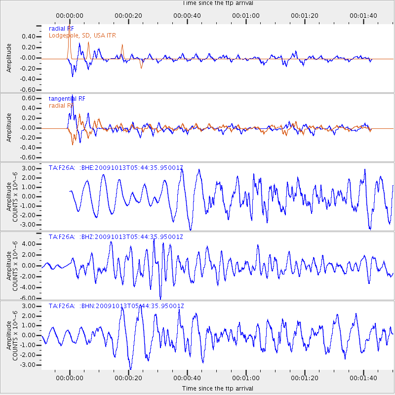
F26A Lodgepole, SD, USA - Earthquake Result Viewer
*The percent match for this event was below the threshold and hence no stack was calculated.
| Earthquake location: |
Fox Islands, Aleutian Islands |
| Earthquake latitude/longitude: |
52.8/-167.0 |
| Earthquake time(UTC): |
2009/10/13 (286) 05:37:23 GMT |
| Earthquake Depth: |
24 km |
| Earthquake Magnitude: |
6.0 MB, 6.1 MS, 6.5 MW, 6.5 MW |
| Earthquake Catalog/Contributor: |
WHDF/NEIC |
|
| Network: |
TA USArray Transportable Network (new EarthScope stations) |
| Station: |
F26A Lodgepole, SD, USA |
| Lat/Lon: |
45.85 N/102.67 W |
| Elevation: |
852 m |
|
| Distance: |
41.2 deg |
| Az: |
72.861 deg |
| Baz: |
303.796 deg |
| Ray Param: |
$rayparam |
*The percent match for this event was below the threshold and hence was not used in the summary stack. |
|
| Radial Match: |
70.42056 % |
| Radial Bump: |
277 |
| Transverse Match: |
73.030594 % |
| Transverse Bump: |
255 |
| SOD ConfigId: |
2622 |
| Insert Time: |
2010-03-07 06:09:48.300 +0000 |
| GWidth: |
2.5 |
| Max Bumps: |
400 |
| Tol: |
0.001 |
|
Signal To Noise
| Channel | StoN | STA | LTA |
| TA:F26A: :BHZ:20091013T05:44:35.95001Z | 2.7991695 | 9.727986E-7 | 3.4753114E-7 |
| TA:F26A: :BHN:20091013T05:44:35.95001Z | 0.760529 | 5.5336363E-7 | 7.276036E-7 |
| TA:F26A: :BHE:20091013T05:44:35.95001Z | 0.9189744 | 1.0685769E-6 | 1.162793E-6 |
| Arrivals |
| Ps | |
| PpPs | |
| PsPs/PpSs | |


