You are here: Home > Network List > TA - USArray Transportable Network (new EarthScope stations) Stations List
> Station F26A Lodgepole, SD, USA > Earthquake Result Viewer
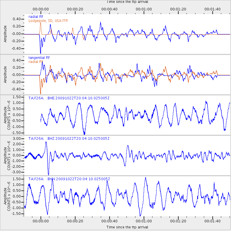
F26A Lodgepole, SD, USA - Earthquake Result Viewer
*The percent match for this event was below the threshold and hence no stack was calculated.
| Earthquake location: |
Hindu Kush Region, Afghanistan |
| Earthquake latitude/longitude: |
36.5/70.9 |
| Earthquake time(UTC): |
2009/10/22 (295) 19:51:27 GMT |
| Earthquake Depth: |
186 km |
| Earthquake Magnitude: |
6.1 MB, 6.2 MW, 6.1 MW |
| Earthquake Catalog/Contributor: |
WHDF/NEIC |
|
| Network: |
TA USArray Transportable Network (new EarthScope stations) |
| Station: |
F26A Lodgepole, SD, USA |
| Lat/Lon: |
45.85 N/102.67 W |
| Elevation: |
852 m |
|
| Distance: |
97.8 deg |
| Az: |
355.504 deg |
| Baz: |
5.184 deg |
| Ray Param: |
$rayparam |
*The percent match for this event was below the threshold and hence was not used in the summary stack. |
|
| Radial Match: |
48.42355 % |
| Radial Bump: |
400 |
| Transverse Match: |
62.429558 % |
| Transverse Bump: |
368 |
| SOD ConfigId: |
2622 |
| Insert Time: |
2010-03-07 06:09:51.954 +0000 |
| GWidth: |
2.5 |
| Max Bumps: |
400 |
| Tol: |
0.001 |
|
Signal To Noise
| Channel | StoN | STA | LTA |
| TA:F26A: :BHZ:20091022T20:04:10.025005Z | 5.3263946 | 1.4798034E-6 | 2.778246E-7 |
| TA:F26A: :BHN:20091022T20:04:10.025005Z | 1.2053425 | 8.2865597E-7 | 6.8748585E-7 |
| TA:F26A: :BHE:20091022T20:04:10.025005Z | 0.99293643 | 5.233462E-7 | 5.2706923E-7 |
| Arrivals |
| Ps | |
| PpPs | |
| PsPs/PpSs | |


