You are here: Home > Network List > IC - New China Digital Seismograph Network Stations List
> Station HIA Hailar, Neimenggu Autonomous Region, China > Earthquake Result Viewer
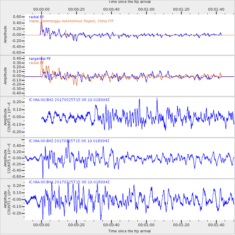
HIA Hailar, Neimenggu Autonomous Region, China - Earthquake Result Viewer
*The percent match for this event was below the threshold and hence no stack was calculated.
| Earthquake location: |
Irian Jaya, Indonesia |
| Earthquake latitude/longitude: |
-3.1/136.9 |
| Earthquake time(UTC): |
2017/03/25 (084) 14:57:25 GMT |
| Earthquake Depth: |
20 km |
| Earthquake Magnitude: |
5.7 Mww |
| Earthquake Catalog/Contributor: |
NEIC PDE/us |
|
| Network: |
IC New China Digital Seismograph Network |
| Station: |
HIA Hailar, Neimenggu Autonomous Region, China |
| Lat/Lon: |
49.27 N/119.74 E |
| Elevation: |
620 m |
|
| Distance: |
54.2 deg |
| Az: |
346.236 deg |
| Baz: |
158.733 deg |
| Ray Param: |
$rayparam |
*The percent match for this event was below the threshold and hence was not used in the summary stack. |
|
| Radial Match: |
67.45242 % |
| Radial Bump: |
400 |
| Transverse Match: |
58.571808 % |
| Transverse Bump: |
400 |
| SOD ConfigId: |
1992691 |
| Insert Time: |
2017-04-08 15:02:55.938 +0000 |
| GWidth: |
2.5 |
| Max Bumps: |
400 |
| Tol: |
0.001 |
|
Signal To Noise
| Channel | StoN | STA | LTA |
| IC:HIA:00:BHZ:20170325T15:06:19.018994Z | 3.5910761 | 2.0189005E-7 | 5.621993E-8 |
| IC:HIA:00:BH1:20170325T15:06:19.018994Z | 2.4253006 | 9.9686474E-8 | 4.110273E-8 |
| IC:HIA:00:BH2:20170325T15:06:19.018994Z | 2.226509 | 8.290172E-8 | 3.723395E-8 |
| Arrivals |
| Ps | |
| PpPs | |
| PsPs/PpSs | |


