You are here: Home > Network List > IC - New China Digital Seismograph Network Stations List
> Station HIA Hailar, Neimenggu Autonomous Region, China > Earthquake Result Viewer
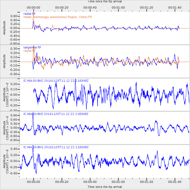
HIA Hailar, Neimenggu Autonomous Region, China - Earthquake Result Viewer
*The percent match for this event was below the threshold and hence no stack was calculated.
| Earthquake location: |
Myanmar |
| Earthquake latitude/longitude: |
19.2/94.9 |
| Earthquake time(UTC): |
2019/11/26 (330) 11:05:57 GMT |
| Earthquake Depth: |
60 km |
| Earthquake Magnitude: |
5.4 Mww |
| Earthquake Catalog/Contributor: |
NEIC PDE/us |
|
| Network: |
IC New China Digital Seismograph Network |
| Station: |
HIA Hailar, Neimenggu Autonomous Region, China |
| Lat/Lon: |
49.27 N/119.74 E |
| Elevation: |
620 m |
|
| Distance: |
36.0 deg |
| Az: |
27.885 deg |
| Baz: |
222.427 deg |
| Ray Param: |
$rayparam |
*The percent match for this event was below the threshold and hence was not used in the summary stack. |
|
| Radial Match: |
63.95064 % |
| Radial Bump: |
400 |
| Transverse Match: |
46.680374 % |
| Transverse Bump: |
400 |
| SOD ConfigId: |
19951751 |
| Insert Time: |
2019-12-10 11:15:37.824 +0000 |
| GWidth: |
2.5 |
| Max Bumps: |
400 |
| Tol: |
0.001 |
|
Signal To Noise
| Channel | StoN | STA | LTA |
| IC:HIA:00:BHZ:20191126T11:12:22.218998Z | 3.2620456 | 3.9499992E-7 | 1.2108963E-7 |
| IC:HIA:00:BH1:20191126T11:12:22.218998Z | 1.782134 | 2.2450591E-7 | 1.2597589E-7 |
| IC:HIA:00:BH2:20191126T11:12:22.218998Z | 1.1168346 | 1.1560396E-7 | 1.0351037E-7 |
| Arrivals |
| Ps | |
| PpPs | |
| PsPs/PpSs | |


