You are here: Home > Network List > IC - New China Digital Seismograph Network Stations List
> Station HIA Hailar, Neimenggu Autonomous Region, China > Earthquake Result Viewer
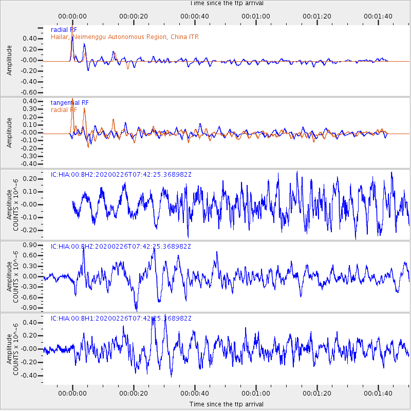
HIA Hailar, Neimenggu Autonomous Region, China - Earthquake Result Viewer
*The percent match for this event was below the threshold and hence no stack was calculated.
| Earthquake location: |
Tanimbar Islands Reg., Indonesia |
| Earthquake latitude/longitude: |
-7.6/131.1 |
| Earthquake time(UTC): |
2020/02/26 (057) 07:33:13 GMT |
| Earthquake Depth: |
61 km |
| Earthquake Magnitude: |
5.9 Mww |
| Earthquake Catalog/Contributor: |
NEIC PDE/us |
|
| Network: |
IC New China Digital Seismograph Network |
| Station: |
HIA Hailar, Neimenggu Autonomous Region, China |
| Lat/Lon: |
49.27 N/119.74 E |
| Elevation: |
620 m |
|
| Distance: |
57.5 deg |
| Az: |
351.183 deg |
| Baz: |
166.585 deg |
| Ray Param: |
$rayparam |
*The percent match for this event was below the threshold and hence was not used in the summary stack. |
|
| Radial Match: |
76.4325 % |
| Radial Bump: |
400 |
| Transverse Match: |
64.81333 % |
| Transverse Bump: |
400 |
| SOD ConfigId: |
20831131 |
| Insert Time: |
2020-03-26 15:24:58.947 +0000 |
| GWidth: |
2.5 |
| Max Bumps: |
400 |
| Tol: |
0.001 |
|
Signal To Noise
| Channel | StoN | STA | LTA |
| IC:HIA:00:BHZ:20200226T07:42:25.368982Z | 3.5726895 | 2.913614E-7 | 8.155239E-8 |
| IC:HIA:00:BH1:20200226T07:42:25.368982Z | 1.40214 | 1.1101963E-7 | 7.9178704E-8 |
| IC:HIA:00:BH2:20200226T07:42:25.368982Z | 1.0847259 | 7.360709E-8 | 6.785778E-8 |
| Arrivals |
| Ps | |
| PpPs | |
| PsPs/PpSs | |


