S241 Paonia - Earthquake Result Viewer
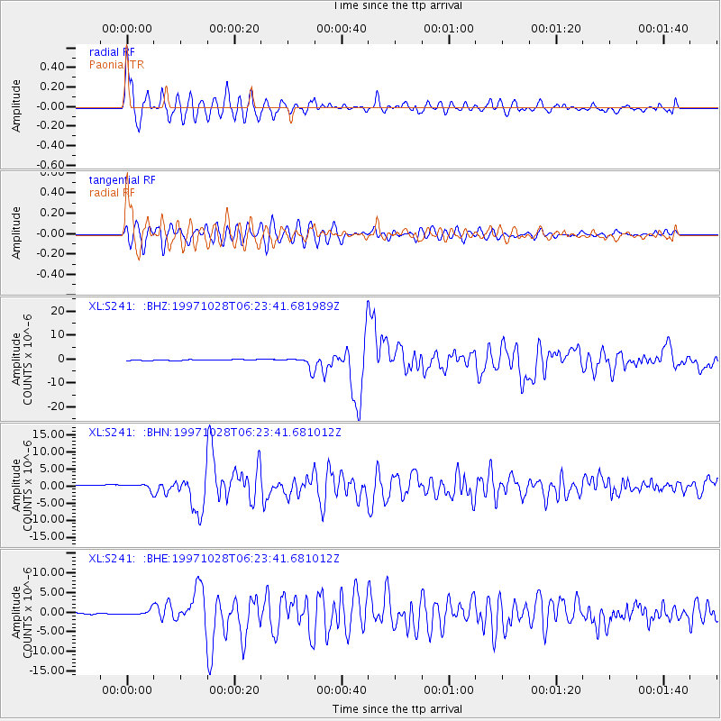
Earthquake location: Northern Peru
Earthquake latitude/longitude: -4.4/-76.7
Earthquake time(UTC): 1997/10/28 (301) 06:15:17 GMT
Earthquake Depth: 112 km
Earthquake Magnitude: 6.6 MB, 6.3 MS, 7.2 UNKNOWN, 6.6 ME
Earthquake Catalog/Contributor: WHDF/NEIC
Network: XL Deep Probe (Archean-Proterozoic)
Station: S241 Paonia
Lat/Lon: 38.84 N/107.54 W
Elevation: 2078 m
Distance: 51.6 deg
Az: 329.26 deg
Baz: 139.257 deg
Ray Param: 0.0669395
Estimated Moho Depth: 50.25 km
Estimated Crust Vp/Vs: 1.78
Assumed Crust Vp: 6.306 km/s
Estimated Crust Vs: 3.548 km/s
Estimated Crust Poisson's Ratio: 0.27
Radial Match: 90.031746 %
Radial Bump: 400
Transverse Match: 74.78652 %
Transverse Bump: 400
SOD ConfigId: 6273
Insert Time: 2010-03-08 18:08:50.861 +0000
GWidth: 2.5
Max Bumps: 400
Tol: 0.001

Signal To Noise

ChannelStoNSTALTA
XL:S241: :BHN:19971028T06:23:41.681012Z1.38379849.76065E-77.0535214E-7
XL:S241: :BHE:19971028T06:23:41.681012Z2.53289918.360092E-73.300602E-7
XL:S241: :BHZ:19971028T06:23:41.681989Z11.5966322.536112E-62.1869384E-7
Arrivals
Ps6.5 SECOND
PpPs21 SECOND
PsPs/PpSs28 SECOND