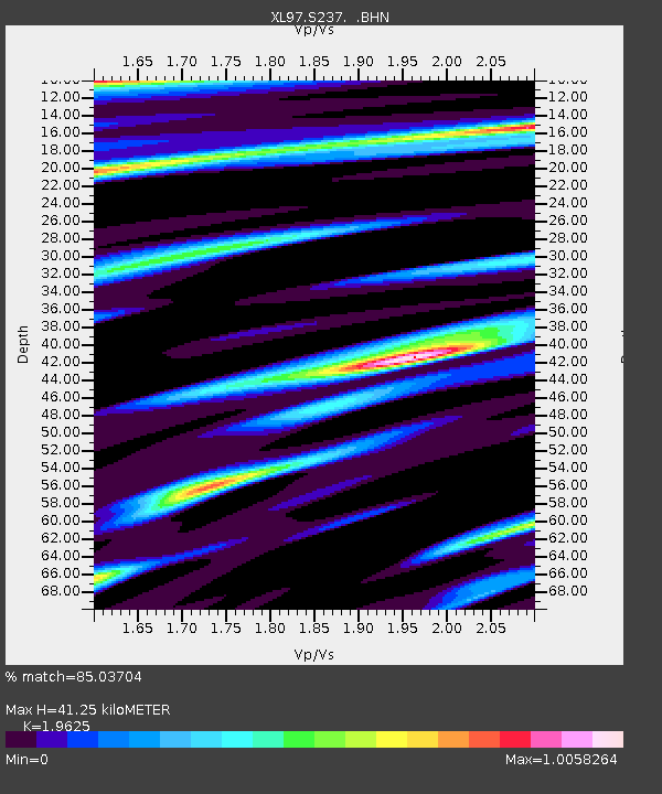
S237 Battlement Mesa - Earthquake Result Viewer
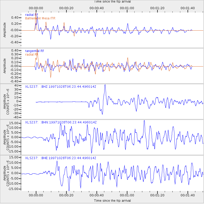
Earthquake location: Northern Peru
Earthquake latitude/longitude: -4.4/-76.7
Earthquake time(UTC): 1997/10/28 (301) 06:15:17 GMT
Earthquake Depth: 112 km
Earthquake Magnitude: 6.6 MB, 6.3 MS, 7.2 UNKNOWN, 6.6 ME
Earthquake Catalog/Contributor: WHDF/NEIC
Network: XL Deep Probe (Archean-Proterozoic)
Station: S237 Battlement Mesa
Lat/Lon: 39.12 N/107.89 W
Elevation: 3012 m
Distance: 52.0 deg
Az: 329.225 deg
Baz: 139.016 deg
Ray Param: 0.06669414
Estimated Moho Depth: 41.25 km
Estimated Crust Vp/Vs: 1.96
Assumed Crust Vp: 6.306 km/s
Estimated Crust Vs: 3.213 km/s
Estimated Crust Poisson's Ratio: 0.32
Radial Match: 85.03704 %
Radial Bump: 374
Transverse Match: 75.30948 %
Transverse Bump: 400
SOD ConfigId: 6273
Insert Time: 2010-03-08 18:09:23.477 +0000
GWidth: 2.5
Max Bumps: 400
Tol: 0.001

Signal To Noise

ChannelStoNSTALTA
XL:S237: :BHN:19971028T06:23:44.496014Z1.34355555.2566173E-73.9124677E-7
XL:S237: :BHE:19971028T06:23:44.496014Z1.18630554.945733E-74.1690214E-7
XL:S237: :BHZ:19971028T06:23:44.496014Z7.5115252.180637E-62.9030548E-7
Arrivals
Ps6.6 SECOND
PpPs18 SECOND
PsPs/PpSs25 SECOND