S144 Uncompahgre Forest - Earthquake Result Viewer
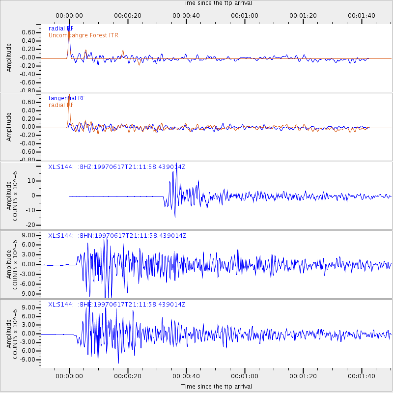
Earthquake location: Andreanof Islands, Aleutian Is.
Earthquake latitude/longitude: 51.3/-179.3
Earthquake time(UTC): 1997/06/17 (168) 21:03:40 GMT
Earthquake Depth: 33 km
Earthquake Magnitude: 6.4 MB, 6.3 MS, 6.4 UNKNOWN, 6.6 ML
Earthquake Catalog/Contributor: WHDF/NEIC
Network: XL Deep Probe (Archean-Proterozoic)
Station: S144 Uncompahgre Forest
Lat/Lon: 38.60 N/108.68 W
Elevation: 2779 m
Distance: 49.7 deg
Az: 75.77 deg
Baz: 309.114 deg
Ray Param: 0.06847337
Estimated Moho Depth: 33.0 km
Estimated Crust Vp/Vs: 2.01
Assumed Crust Vp: 6.291 km/s
Estimated Crust Vs: 3.138 km/s
Estimated Crust Poisson's Ratio: 0.33
Radial Match: 93.66063 %
Radial Bump: 400
Transverse Match: 87.6563 %
Transverse Bump: 400
SOD ConfigId: 6273
Insert Time: 2010-03-08 18:09:29.102 +0000
GWidth: 2.5
Max Bumps: 400
Tol: 0.001

Signal To Noise

ChannelStoNSTALTA
XL:S144: :BHN:19970617T21:11:58.439014Z23.0094241.6006888E-66.956666E-8
XL:S144: :BHE:19970617T21:11:58.439014Z11.7786571.6547874E-61.4049033E-7
XL:S144: :BHZ:19970617T21:11:58.439014Z59.2477383.6318545E-66.129946E-8
Arrivals
Ps5.5 SECOND
PpPs15 SECOND
PsPs/PpSs21 SECOND