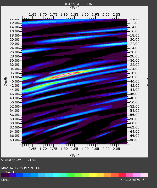
S141 Mud Springs Rec. Area - Earthquake Result Viewer
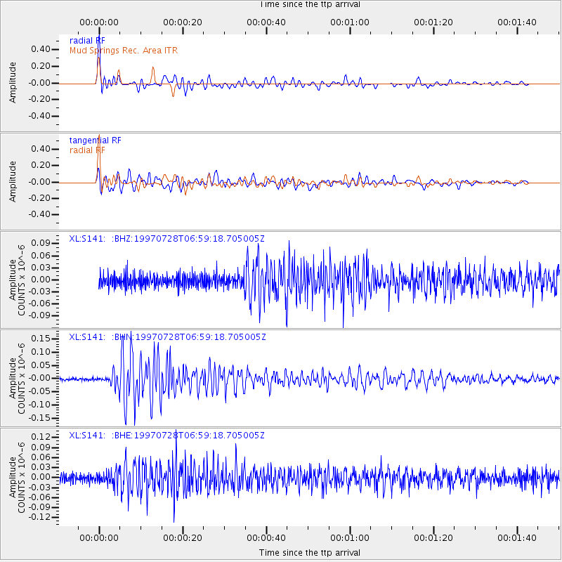
Earthquake location: Volcano Islands, Japan Region
Earthquake latitude/longitude: 22.4/142.7
Earthquake time(UTC): 1997/07/28 (209) 06:46:55 GMT
Earthquake Depth: 33 km
Earthquake Magnitude: 5.7 MB, 5.8 MS, 5.9 UNKNOWN, 5.9 MW
Earthquake Catalog/Contributor: WHDF/NEIC
Network: XL Deep Probe (Archean-Proterozoic)
Station: S141 Mud Springs Rec. Area
Lat/Lon: 38.88 N/108.76 W
Elevation: 2615 m
Distance: 89.6 deg
Az: 47.743 deg
Baz: 298.613 deg
Ray Param: 0.041729636
Estimated Moho Depth: 36.75 km
Estimated Crust Vp/Vs: 1.80
Assumed Crust Vp: 6.291 km/s
Estimated Crust Vs: 3.495 km/s
Estimated Crust Poisson's Ratio: 0.28
Radial Match: 95.102104 %
Radial Bump: 400
Transverse Match: 91.83085 %
Transverse Bump: 400
SOD ConfigId: 4480
Insert Time: 2010-03-08 18:10:13.965 +0000
GWidth: 2.5
Max Bumps: 400
Tol: 0.001

Signal To Noise

ChannelStoNSTALTA
XL:S141: :BHN:19970728T06:59:18.705005Z4.79940372.3932694E-84.986598E-9
XL:S141: :BHE:19970728T06:59:18.705005Z1.37558251.9315884E-81.4041968E-8
XL:S141: :BHZ:19970728T06:59:18.705005Z0.86766091.38182275E-81.592584E-8
Arrivals
Ps4.8 SECOND
PpPs16 SECOND
PsPs/PpSs21 SECOND