S141 Mud Springs Rec. Area - Earthquake Result Viewer
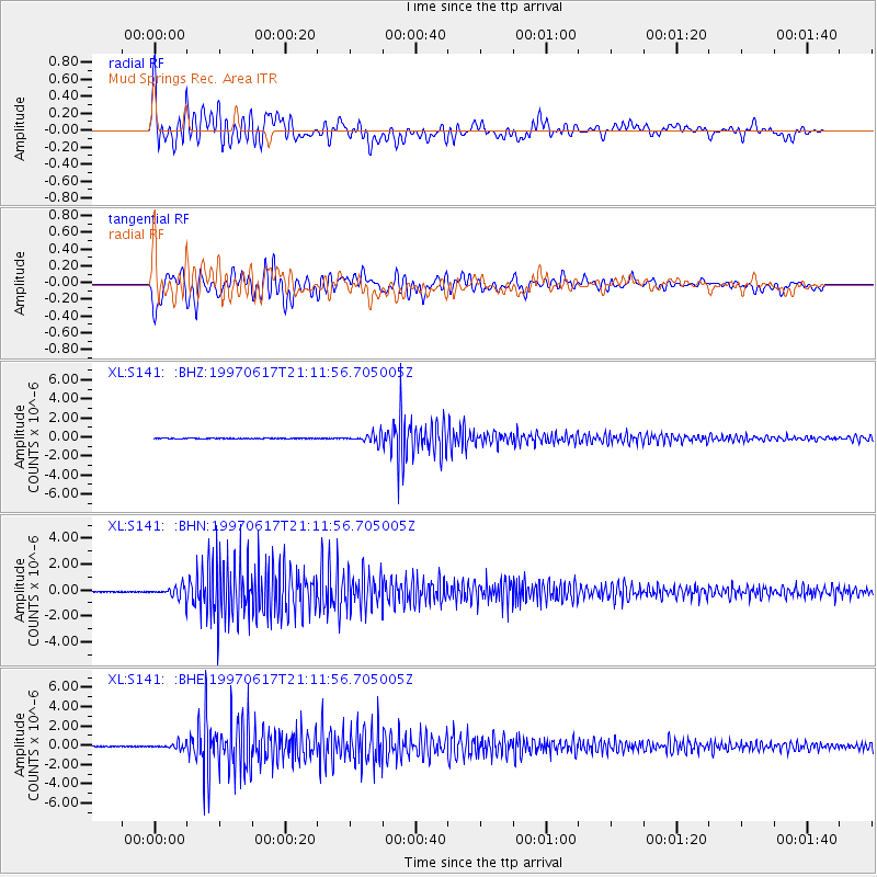
Earthquake location: Andreanof Islands, Aleutian Is.
Earthquake latitude/longitude: 51.3/-179.3
Earthquake time(UTC): 1997/06/17 (168) 21:03:40 GMT
Earthquake Depth: 33 km
Earthquake Magnitude: 6.4 MB, 6.3 MS, 6.4 UNKNOWN, 6.6 ML
Earthquake Catalog/Contributor: WHDF/NEIC
Network: XL Deep Probe (Archean-Proterozoic)
Station: S141 Mud Springs Rec. Area
Lat/Lon: 38.88 N/108.76 W
Elevation: 2615 m
Distance: 49.5 deg
Az: 75.535 deg
Baz: 308.915 deg
Ray Param: 0.06861348
Estimated Moho Depth: 44.5 km
Estimated Crust Vp/Vs: 1.66
Assumed Crust Vp: 6.291 km/s
Estimated Crust Vs: 3.778 km/s
Estimated Crust Poisson's Ratio: 0.22
Radial Match: 84.90793 %
Radial Bump: 400
Transverse Match: 80.19062 %
Transverse Bump: 400
SOD ConfigId: 6273
Insert Time: 2010-03-08 18:10:16.257 +0000
GWidth: 2.5
Max Bumps: 400
Tol: 0.001

Signal To Noise

ChannelStoNSTALTA
XL:S141: :BHN:19970617T21:11:56.705005Z36.8542334.0148635E-71.08939E-8
XL:S141: :BHE:19970617T21:11:56.705005Z28.0381762.540699E-79.06157E-9
XL:S141: :BHZ:19970617T21:11:56.705005Z136.076724.4254642E-73.2521832E-9
Arrivals
Ps5.0 SECOND
PpPs18 SECOND
PsPs/PpSs23 SECOND