S141 Mud Springs Rec. Area - Earthquake Result Viewer
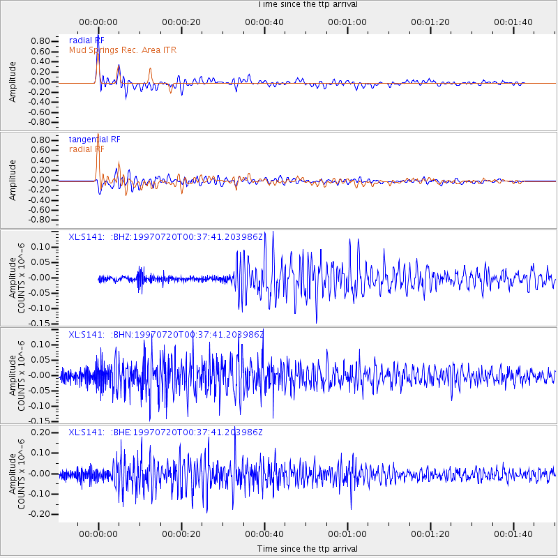
Earthquake location: Fox Islands, Aleutian Islands
Earthquake latitude/longitude: 52.6/-167.5
Earthquake time(UTC): 1997/07/20 (201) 00:30:20 GMT
Earthquake Depth: 14 km
Earthquake Magnitude: 5.6 MB, 5.9 MS, 6.2 UNKNOWN, 6.2 MW
Earthquake Catalog/Contributor: WHDF/NEIC
Network: XL Deep Probe (Archean-Proterozoic)
Station: S141 Mud Springs Rec. Area
Lat/Lon: 38.88 N/108.76 W
Elevation: 2615 m
Distance: 42.1 deg
Az: 84.799 deg
Baz: 308.835 deg
Ray Param: 0.07338939
Estimated Moho Depth: 36.75 km
Estimated Crust Vp/Vs: 1.79
Assumed Crust Vp: 6.291 km/s
Estimated Crust Vs: 3.514 km/s
Estimated Crust Poisson's Ratio: 0.27
Radial Match: 92.49629 %
Radial Bump: 400
Transverse Match: 81.39347 %
Transverse Bump: 400
SOD ConfigId: 6273
Insert Time: 2010-03-08 18:10:18.539 +0000
GWidth: 2.5
Max Bumps: 400
Tol: 0.001

Signal To Noise

ChannelStoNSTALTA
XL:S141: :BHN:19970720T00:37:41.203986Z1.95009024.5415142E-82.3288738E-8
XL:S141: :BHE:19970720T00:37:41.203986Z1.71909173.7974377E-82.2089791E-8
XL:S141: :BHZ:19970720T00:37:41.203986Z3.77507733.7992265E-81.006397E-8
Arrivals
Ps4.9 SECOND
PpPs15 SECOND
PsPs/PpSs20 SECOND