S129 Philadephia Creek - Earthquake Result Viewer
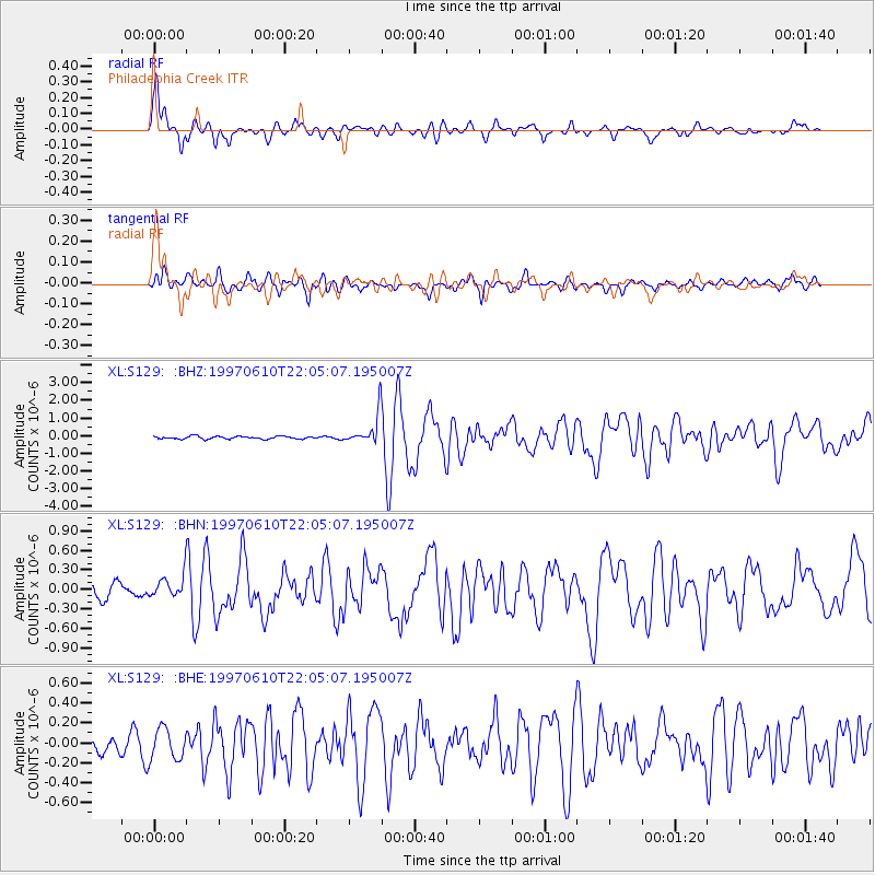
Earthquake location: Southern East Pacific Rise
Earthquake latitude/longitude: -35.8/-108.1
Earthquake time(UTC): 1997/06/10 (161) 21:53:55 GMT
Earthquake Depth: 10 km
Earthquake Magnitude: 5.8 MB, 6.1 MS, 6.5 UNKNOWN, 5.8 MS
Earthquake Catalog/Contributor: WHDF/NEIC
Network: XL Deep Probe (Archean-Proterozoic)
Station: S129 Philadephia Creek
Lat/Lon: 39.91 N/108.68 W
Elevation: 1929 m
Distance: 75.4 deg
Az: 359.565 deg
Baz: 179.54 deg
Ray Param: 0.051723998
Estimated Moho Depth: 51.5 km
Estimated Crust Vp/Vs: 1.76
Assumed Crust Vp: 6.291 km/s
Estimated Crust Vs: 3.579 km/s
Estimated Crust Poisson's Ratio: 0.26
Radial Match: 91.2654 %
Radial Bump: 400
Transverse Match: 75.89286 %
Transverse Bump: 400
SOD ConfigId: 6273
Insert Time: 2010-03-08 18:10:26.313 +0000
GWidth: 2.5
Max Bumps: 400
Tol: 0.001

Signal To Noise

ChannelStoNSTALTA
XL:S129: :BHN:19970610T22:05:07.195007Z1.54424571.680412E-71.0881766E-7
XL:S129: :BHE:19970610T22:05:07.195007Z2.29722121.5843884E-76.896978E-8
XL:S129: :BHZ:19970610T22:05:07.195007Z10.1724098.123116E-77.98544E-8
Arrivals
Ps6.4 SECOND
PpPs22 SECOND
PsPs/PpSs28 SECOND