S125 Martins Gap - Earthquake Result Viewer
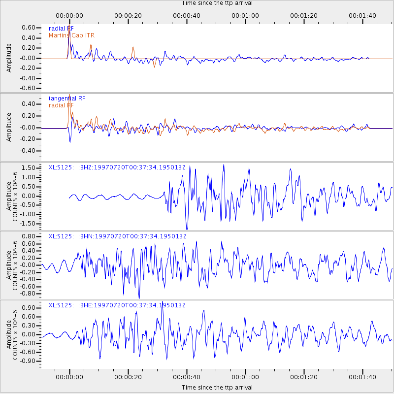
Earthquake location: Fox Islands, Aleutian Islands
Earthquake latitude/longitude: 52.6/-167.5
Earthquake time(UTC): 1997/07/20 (201) 00:30:20 GMT
Earthquake Depth: 14 km
Earthquake Magnitude: 5.6 MB, 5.9 MS, 6.2 UNKNOWN, 6.2 MW
Earthquake Catalog/Contributor: WHDF/NEIC
Network: XL Deep Probe (Archean-Proterozoic)
Station: S125 Martins Gap
Lat/Lon: 40.26 N/108.77 W
Elevation: 1849 m
Distance: 41.2 deg
Az: 83.178 deg
Baz: 307.618 deg
Ray Param: 0.07393335
Estimated Moho Depth: 10.0 km
Estimated Crust Vp/Vs: 1.60
Assumed Crust Vp: 6.207 km/s
Estimated Crust Vs: 3.879 km/s
Estimated Crust Poisson's Ratio: 0.18
Radial Match: 87.5371 %
Radial Bump: 400
Transverse Match: 84.144646 %
Transverse Bump: 400
SOD ConfigId: 6273
Insert Time: 2010-03-08 18:10:48.565 +0000
GWidth: 2.5
Max Bumps: 400
Tol: 0.001

Signal To Noise

ChannelStoNSTALTA
XL:S125: :BHN:19970720T00:37:34.195013Z3.23320632.0546742E-76.354912E-8
XL:S125: :BHE:19970720T00:37:34.195013Z2.22425341.4846748E-76.674935E-8
XL:S125: :BHZ:19970720T00:37:34.195013Z3.45736053.276881E-79.477985E-8
Arrivals
Ps1.0 SECOND
PpPs3.9 SECOND
PsPs/PpSs4.9 SECOND