S131 Rope Canyon - Earthquake Result Viewer
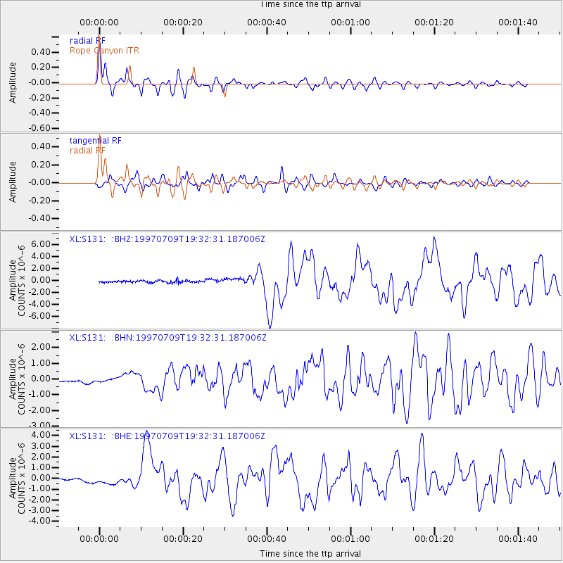
Earthquake location: Near Coast Of Venezuela
Earthquake latitude/longitude: 10.6/-63.5
Earthquake time(UTC): 1997/07/09 (190) 19:24:13 GMT
Earthquake Depth: 20 km
Earthquake Magnitude: 6.2 MB, 6.8 MS, 7.0 UNKNOWN, 6.6 ME
Earthquake Catalog/Contributor: WHDF/NEIC
Network: XL Deep Probe (Archean-Proterozoic)
Station: S131 Rope Canyon
Lat/Lon: 39.75 N/108.77 W
Elevation: 2072 m
Distance: 49.5 deg
Az: 313.89 deg
Baz: 113.217 deg
Ray Param: 0.068647824
Estimated Moho Depth: 43.0 km
Estimated Crust Vp/Vs: 1.92
Assumed Crust Vp: 6.291 km/s
Estimated Crust Vs: 3.276 km/s
Estimated Crust Poisson's Ratio: 0.31
Radial Match: 91.7358 %
Radial Bump: 400
Transverse Match: 82.99529 %
Transverse Bump: 400
SOD ConfigId: 6273
Insert Time: 2010-03-08 18:11:54.423 +0000
GWidth: 2.5
Max Bumps: 400
Tol: 0.001

Signal To Noise

ChannelStoNSTALTA
XL:S131: :BHN:19970709T19:32:31.187006Z0.764749771.0239666E-71.3389565E-7
XL:S131: :BHE:19970709T19:32:31.187006Z1.58172063.4723405E-72.1952933E-7
XL:S131: :BHZ:19970709T19:32:31.187006Z2.4761894.1851084E-71.6901409E-7
Arrivals
Ps6.6 SECOND
PpPs19 SECOND
PsPs/PpSs26 SECOND