S130 Little Horse Draw - Earthquake Result Viewer
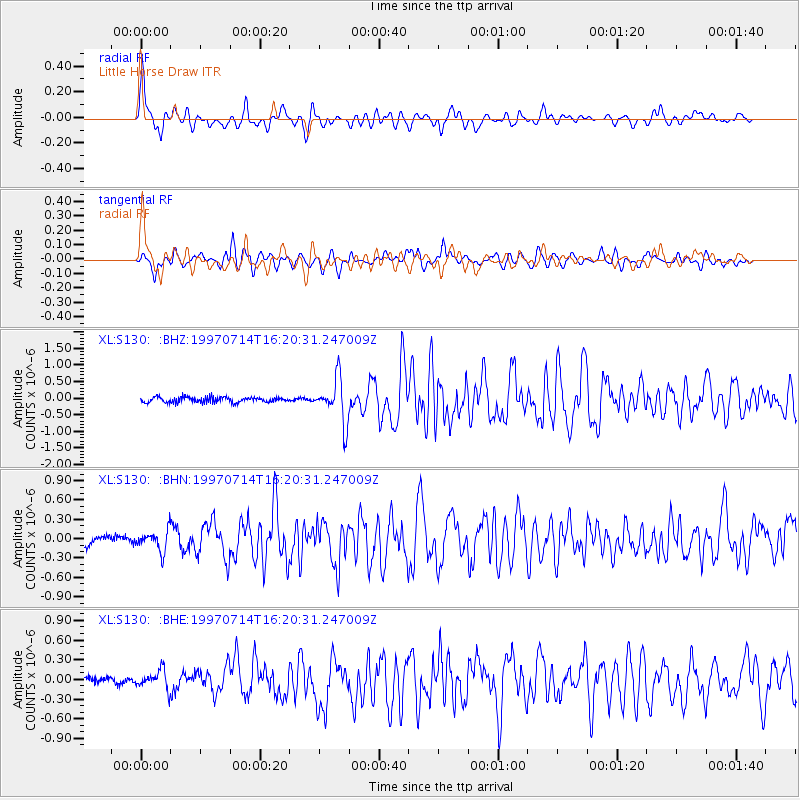
Earthquake location: Kuril Islands
Earthquake latitude/longitude: 43.2/146.4
Earthquake time(UTC): 1997/07/14 (195) 16:09:35 GMT
Earthquake Depth: 33 km
Earthquake Magnitude: 5.9 MB, 5.8 MS, 6.1 UNKNOWN, 5.8 ME
Earthquake Catalog/Contributor: WHDF/NEIC
Network: XL Deep Probe (Archean-Proterozoic)
Station: S130 Little Horse Draw
Lat/Lon: 39.84 N/108.77 W
Elevation: 1932 m
Distance: 73.1 deg
Az: 51.082 deg
Baz: 312.409 deg
Ray Param: 0.053209998
Estimated Moho Depth: 55.75 km
Estimated Crust Vp/Vs: 1.60
Assumed Crust Vp: 6.291 km/s
Estimated Crust Vs: 3.932 km/s
Estimated Crust Poisson's Ratio: 0.18
Radial Match: 87.1033 %
Radial Bump: 400
Transverse Match: 82.217445 %
Transverse Bump: 400
SOD ConfigId: 6273
Insert Time: 2010-03-08 18:12:41.554 +0000
GWidth: 2.5
Max Bumps: 400
Tol: 0.001

Signal To Noise

ChannelStoNSTALTA
XL:S130: :BHN:19970714T16:20:31.247009Z2.42289761.608877E-76.640301E-8
XL:S130: :BHE:19970714T16:20:31.247009Z2.33417871.5345938E-76.574449E-8
XL:S130: :BHZ:19970714T16:20:31.247009Z8.1022776.562728E-78.099856E-8
Arrivals
Ps5.5 SECOND
PpPs22 SECOND
PsPs/PpSs28 SECOND