S122 Five Springs Road - Earthquake Result Viewer
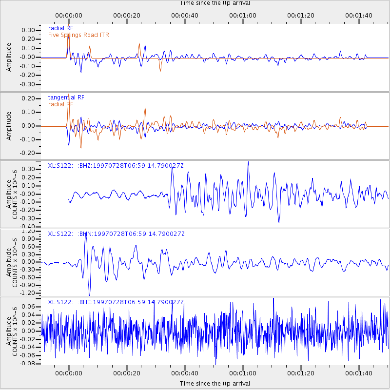
Earthquake location: Volcano Islands, Japan Region
Earthquake latitude/longitude: 22.4/142.7
Earthquake time(UTC): 1997/07/28 (209) 06:46:55 GMT
Earthquake Depth: 33 km
Earthquake Magnitude: 5.7 MB, 5.8 MS, 5.9 UNKNOWN, 5.9 MW
Earthquake Catalog/Contributor: WHDF/NEIC
Network: XL Deep Probe (Archean-Proterozoic)
Station: S122 Five Springs Road
Lat/Lon: 40.60 N/108.79 W
Elevation: 2093 m
Distance: 88.8 deg
Az: 46.25 deg
Baz: 298.573 deg
Ray Param: 0.042309098
Estimated Moho Depth: 35.0 km
Estimated Crust Vp/Vs: 1.60
Assumed Crust Vp: 6.207 km/s
Estimated Crust Vs: 3.879 km/s
Estimated Crust Poisson's Ratio: 0.18
Radial Match: 83.85051 %
Radial Bump: 400
Transverse Match: 82.31957 %
Transverse Bump: 400
SOD ConfigId: 4480
Insert Time: 2010-03-08 18:13:15.859 +0000
GWidth: 2.5
Max Bumps: 400
Tol: 0.001

Signal To Noise

ChannelStoNSTALTA
XL:S122: :BHN:19970728T06:59:14.790027Z2.3709471.6526306E-76.9703404E-8
XL:S122: :BHE:19970728T06:59:14.790027Z0.964163242.51721E-82.6107717E-8
XL:S122: :BHZ:19970728T06:59:14.790027Z1.19399143.940495E-83.3002706E-8
Arrivals
Ps3.5 SECOND
PpPs14 SECOND
PsPs/PpSs18 SECOND