S122 Five Springs Road - Earthquake Result Viewer
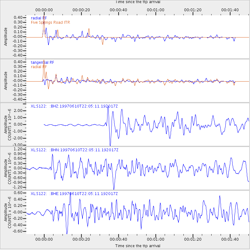
Earthquake location: Southern East Pacific Rise
Earthquake latitude/longitude: -35.8/-108.1
Earthquake time(UTC): 1997/06/10 (161) 21:53:55 GMT
Earthquake Depth: 10 km
Earthquake Magnitude: 5.8 MB, 6.1 MS, 6.5 UNKNOWN, 5.8 MS
Earthquake Catalog/Contributor: WHDF/NEIC
Network: XL Deep Probe (Archean-Proterozoic)
Station: S122 Five Springs Road
Lat/Lon: 40.60 N/108.79 W
Elevation: 2093 m
Distance: 76.0 deg
Az: 359.486 deg
Baz: 179.452 deg
Ray Param: 0.05126011
Estimated Moho Depth: 55.5 km
Estimated Crust Vp/Vs: 1.71
Assumed Crust Vp: 6.207 km/s
Estimated Crust Vs: 3.625 km/s
Estimated Crust Poisson's Ratio: 0.24
Radial Match: 92.13113 %
Radial Bump: 315
Transverse Match: 80.761345 %
Transverse Bump: 400
SOD ConfigId: 6273
Insert Time: 2010-03-08 18:13:17.530 +0000
GWidth: 2.5
Max Bumps: 400
Tol: 0.001

Signal To Noise

ChannelStoNSTALTA
XL:S122: :BHN:19970610T22:05:11.192017Z5.51987742.8141392E-75.0981917E-8
XL:S122: :BHE:19970610T22:05:11.192017Z1.65093068.0128E-84.8535046E-8
XL:S122: :BHZ:19970610T22:05:11.192017Z12.3720518.5371244E-76.9003306E-8
Arrivals
Ps6.6 SECOND
PpPs24 SECOND
PsPs/PpSs30 SECOND