S122 Five Springs Road - Earthquake Result Viewer
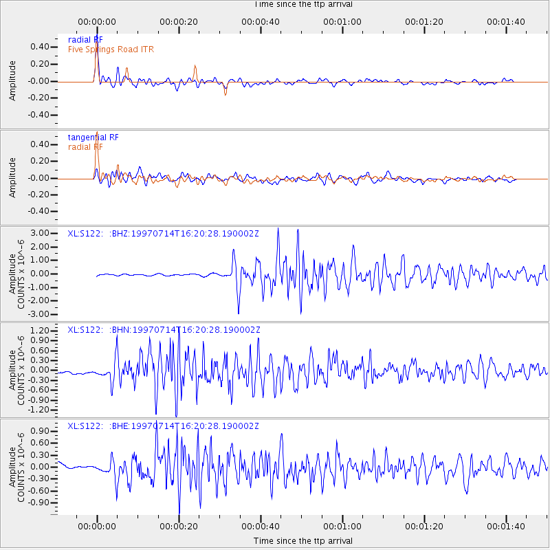
Earthquake location: Kuril Islands
Earthquake latitude/longitude: 43.2/146.4
Earthquake time(UTC): 1997/07/14 (195) 16:09:35 GMT
Earthquake Depth: 33 km
Earthquake Magnitude: 5.9 MB, 5.8 MS, 6.1 UNKNOWN, 5.8 ME
Earthquake Catalog/Contributor: WHDF/NEIC
Network: XL Deep Probe (Archean-Proterozoic)
Station: S122 Five Springs Road
Lat/Lon: 40.60 N/108.79 W
Elevation: 2093 m
Distance: 72.5 deg
Az: 50.504 deg
Baz: 312.227 deg
Ray Param: 0.053550027
Estimated Moho Depth: 14.75 km
Estimated Crust Vp/Vs: 2.09
Assumed Crust Vp: 6.207 km/s
Estimated Crust Vs: 2.973 km/s
Estimated Crust Poisson's Ratio: 0.35
Radial Match: 90.42125 %
Radial Bump: 400
Transverse Match: 84.742874 %
Transverse Bump: 400
SOD ConfigId: 6273
Insert Time: 2010-03-08 18:13:20.004 +0000
GWidth: 2.5
Max Bumps: 400
Tol: 0.001

Signal To Noise

ChannelStoNSTALTA
XL:S122: :BHN:19970714T16:20:28.190002Z4.52990343.345109E-77.384504E-8
XL:S122: :BHE:19970714T16:20:28.190002Z2.32358242.180714E-79.385138E-8
XL:S122: :BHZ:19970714T16:20:28.190002Z18.9089269.312687E-74.9250215E-8
Arrivals
Ps2.7 SECOND
PpPs7.1 SECOND
PsPs/PpSs9.8 SECOND