S217 Big Brush Creek - Earthquake Result Viewer
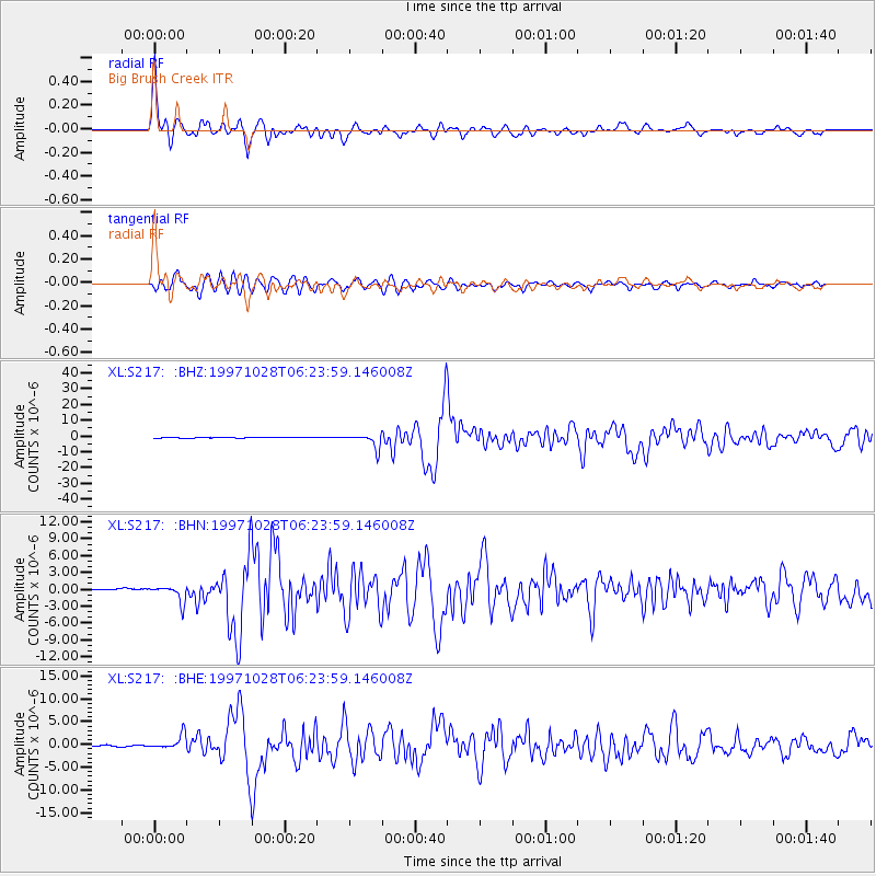
Earthquake location: Northern Peru
Earthquake latitude/longitude: -4.4/-76.7
Earthquake time(UTC): 1997/10/28 (301) 06:15:17 GMT
Earthquake Depth: 112 km
Earthquake Magnitude: 6.6 MB, 6.3 MS, 7.2 UNKNOWN, 6.6 ME
Earthquake Catalog/Contributor: WHDF/NEIC
Network: XL Deep Probe (Archean-Proterozoic)
Station: S217 Big Brush Creek
Lat/Lon: 40.70 N/109.51 W
Elevation: 2577 m
Distance: 54.0 deg
Az: 329.363 deg
Baz: 138.063 deg
Ray Param: 0.06538964
Estimated Moho Depth: 23.5 km
Estimated Crust Vp/Vs: 1.95
Assumed Crust Vp: 6.207 km/s
Estimated Crust Vs: 3.191 km/s
Estimated Crust Poisson's Ratio: 0.32
Radial Match: 93.299934 %
Radial Bump: 400
Transverse Match: 86.11027 %
Transverse Bump: 400
SOD ConfigId: 6273
Insert Time: 2010-03-08 18:13:51.608 +0000
GWidth: 2.5
Max Bumps: 400
Tol: 0.001

Signal To Noise

ChannelStoNSTALTA
XL:S217: :BHN:19971028T06:23:59.146008Z5.0450151.4434527E-62.8611467E-7
XL:S217: :BHE:19971028T06:23:59.146008Z8.1141591.5827633E-61.950619E-7
XL:S217: :BHZ:19971028T06:23:59.146008Z25.7682974.4751832E-61.7367012E-7
Arrivals
Ps3.7 SECOND
PpPs11 SECOND
PsPs/PpSs14 SECOND