S214 Birch Spring Draw - Earthquake Result Viewer
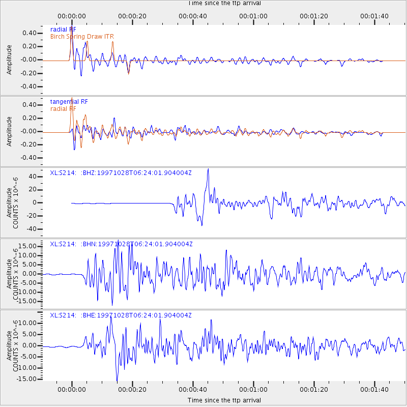
Earthquake location: Northern Peru
Earthquake latitude/longitude: -4.4/-76.7
Earthquake time(UTC): 1997/10/28 (301) 06:15:17 GMT
Earthquake Depth: 112 km
Earthquake Magnitude: 6.6 MB, 6.3 MS, 7.2 UNKNOWN, 6.6 ME
Earthquake Catalog/Contributor: WHDF/NEIC
Network: XL Deep Probe (Archean-Proterozoic)
Station: S214 Birch Spring Draw
Lat/Lon: 40.97 N/109.86 W
Elevation: 2377 m
Distance: 54.4 deg
Az: 329.342 deg
Baz: 137.821 deg
Ray Param: 0.06514462
Estimated Moho Depth: 13.0 km
Estimated Crust Vp/Vs: 1.82
Assumed Crust Vp: 6.207 km/s
Estimated Crust Vs: 3.415 km/s
Estimated Crust Poisson's Ratio: 0.28
Radial Match: 91.014175 %
Radial Bump: 400
Transverse Match: 90.07052 %
Transverse Bump: 400
SOD ConfigId: 6273
Insert Time: 2010-03-08 18:14:09.364 +0000
GWidth: 2.5
Max Bumps: 400
Tol: 0.001

Signal To Noise

ChannelStoNSTALTA
XL:S214: :BHN:19971028T06:24:01.904004Z8.5249341.4917055E-61.7498148E-7
XL:S214: :BHE:19971028T06:24:01.904004Z11.6003941.3781976E-61.188061E-7
XL:S214: :BHZ:19971028T06:24:01.904004Z26.286564.920826E-61.8719932E-7
Arrivals
Ps1.8 SECOND
PpPs5.6 SECOND
PsPs/PpSs7.4 SECOND