S117 Milepost 54 - Earthquake Result Viewer
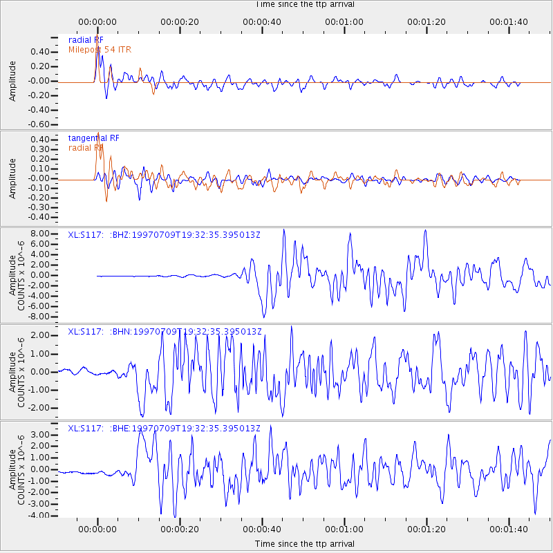
Earthquake location: Near Coast Of Venezuela
Earthquake latitude/longitude: 10.6/-63.5
Earthquake time(UTC): 1997/07/09 (190) 19:24:13 GMT
Earthquake Depth: 20 km
Earthquake Magnitude: 6.2 MB, 6.8 MS, 7.0 UNKNOWN, 6.6 ME
Earthquake Catalog/Contributor: WHDF/NEIC
Network: XL Deep Probe (Archean-Proterozoic)
Station: S117 Milepost 54
Lat/Lon: 41.02 N/108.83 W
Elevation: 2195 m
Distance: 50.0 deg
Az: 315.384 deg
Baz: 114.14 deg
Ray Param: 0.0682956
Estimated Moho Depth: 27.75 km
Estimated Crust Vp/Vs: 1.69
Assumed Crust Vp: 6.207 km/s
Estimated Crust Vs: 3.667 km/s
Estimated Crust Poisson's Ratio: 0.23
Radial Match: 90.17244 %
Radial Bump: 400
Transverse Match: 81.54109 %
Transverse Bump: 400
SOD ConfigId: 6273
Insert Time: 2010-03-08 18:15:08.860 +0000
GWidth: 2.5
Max Bumps: 400
Tol: 0.001

Signal To Noise

ChannelStoNSTALTA
XL:S117: :BHN:19970709T19:32:35.395013Z1.12492619.57462E-88.511333E-8
XL:S117: :BHE:19970709T19:32:35.395013Z2.08633422.4617904E-71.17995974E-7
XL:S117: :BHZ:19970709T19:32:35.395013Z2.45178652.5106252E-71.02399824E-7
Arrivals
Ps3.3 SECOND
PpPs11 SECOND
PsPs/PpSs15 SECOND