S117 Milepost 54 - Earthquake Result Viewer
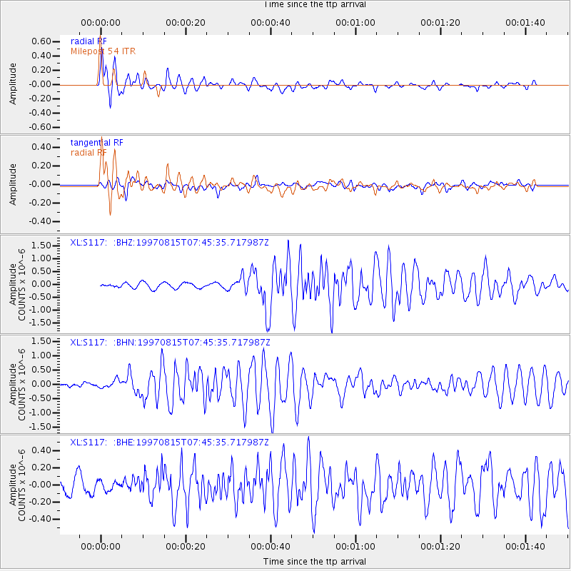
Earthquake location: Central East Pacific Rise
Earthquake latitude/longitude: -4.4/-105.7
Earthquake time(UTC): 1997/08/15 (227) 07:37:49 GMT
Earthquake Depth: 10 km
Earthquake Magnitude: 5.3 MB, 5.8 MS, 6.2 UNKNOWN, 6.1 MW
Earthquake Catalog/Contributor: WHDF/NEIC
Network: XL Deep Probe (Archean-Proterozoic)
Station: S117 Milepost 54
Lat/Lon: 41.02 N/108.83 W
Elevation: 2195 m
Distance: 45.3 deg
Az: 356.658 deg
Baz: 175.595 deg
Ray Param: 0.07139503
Estimated Moho Depth: 18.5 km
Estimated Crust Vp/Vs: 2.09
Assumed Crust Vp: 6.207 km/s
Estimated Crust Vs: 2.977 km/s
Estimated Crust Poisson's Ratio: 0.35
Radial Match: 93.95174 %
Radial Bump: 400
Transverse Match: 74.80576 %
Transverse Bump: 400
SOD ConfigId: 6273
Insert Time: 2010-03-08 18:15:09.867 +0000
GWidth: 2.5
Max Bumps: 400
Tol: 0.001

Signal To Noise

ChannelStoNSTALTA
XL:S117: :BHN:19970815T07:45:35.717987Z2.095291.5472064E-77.384211E-8
XL:S117: :BHE:19970815T07:45:35.717987Z0.638555655.3082303E-88.31287E-8
XL:S117: :BHZ:19970815T07:45:35.717987Z2.41299082.504472E-71.037912E-7
Arrivals
Ps3.4 SECOND
PpPs8.7 SECOND
PsPs/PpSs12 SECOND