S117 Milepost 54 - Earthquake Result Viewer
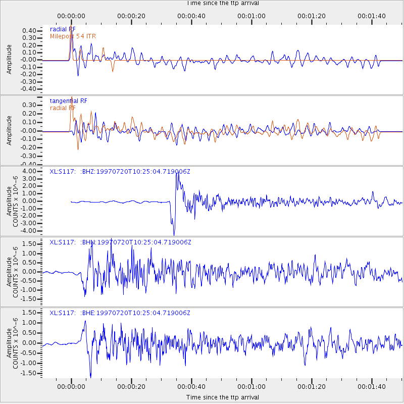
Earthquake location: Jujuy Province, Argentina
Earthquake latitude/longitude: -23.0/-66.3
Earthquake time(UTC): 1997/07/20 (201) 10:14:22 GMT
Earthquake Depth: 256 km
Earthquake Magnitude: 5.7 MB, 6.1 UNKNOWN, 5.7 ME
Earthquake Catalog/Contributor: WHDF/NEIC
Network: XL Deep Probe (Archean-Proterozoic)
Station: S117 Milepost 54
Lat/Lon: 41.02 N/108.83 W
Elevation: 2195 m
Distance: 74.9 deg
Az: 328.01 deg
Baz: 139.82 deg
Ray Param: 0.05130984
Estimated Moho Depth: 46.25 km
Estimated Crust Vp/Vs: 1.90
Assumed Crust Vp: 6.207 km/s
Estimated Crust Vs: 3.267 km/s
Estimated Crust Poisson's Ratio: 0.31
Radial Match: 82.66079 %
Radial Bump: 400
Transverse Match: 81.51445 %
Transverse Bump: 400
SOD ConfigId: 6273
Insert Time: 2010-03-08 18:15:10.786 +0000
GWidth: 2.5
Max Bumps: 400
Tol: 0.001

Signal To Noise

ChannelStoNSTALTA
XL:S117: :BHN:19970720T10:25:04.719006Z5.381864.402498E-78.180254E-8
XL:S117: :BHE:19970720T10:25:04.719006Z4.2822214.15584E-79.7048705E-8
XL:S117: :BHZ:19970720T10:25:04.719006Z21.0308531.6680613E-67.931496E-8
Arrivals
Ps6.9 SECOND
PpPs21 SECOND
PsPs/PpSs28 SECOND