
S111 Milepost 18 - Earthquake Result Viewer
| ||||||||||||||||||
| ||||||||||||||||||
| ||||||||||||||||||
|
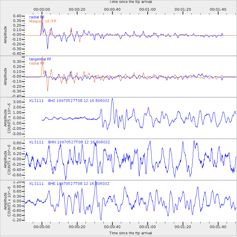
Signal To Noise
| Channel | StoN | STA | LTA |
| XL:S111: :BHN:19970527T08:12:16.80603Z | 1.1670357 | 2.1872818E-7 | 1.87422E-7 |
| XL:S111: :BHE:19970527T08:12:16.80603Z | 4.731227 | 3.0244357E-7 | 6.392497E-8 |
| XL:S111: :BHZ:19970527T08:12:16.80603Z | 4.428842 | 7.142798E-7 | 1.6127913E-7 |
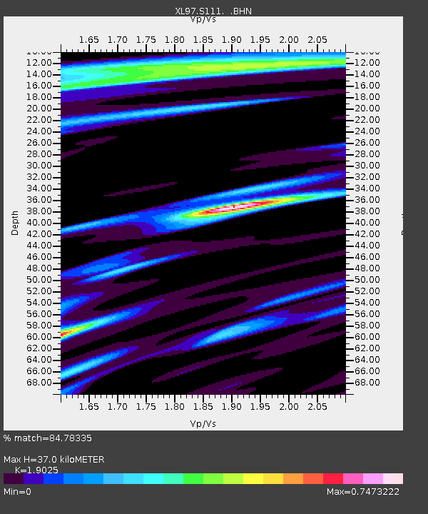
| Arrivals | |
| Ps | 5.5 SECOND |
| PpPs | 17 SECOND |
| PsPs/PpSs | 22 SECOND |

