
S111 Milepost 18 - Earthquake Result Viewer
| ||||||||||||||||||
| ||||||||||||||||||
| ||||||||||||||||||
|
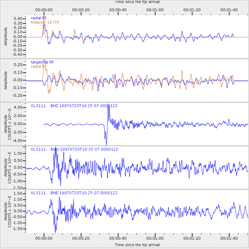
Signal To Noise
| Channel | StoN | STA | LTA |
| XL:S111: :BHN:19970720T10:25:07.000012Z | 3.7594702 | 3.8712707E-7 | 1.0297383E-7 |
| XL:S111: :BHE:19970720T10:25:07.000012Z | 3.368215 | 3.805263E-7 | 1.12975655E-7 |
| XL:S111: :BHZ:19970720T10:25:07.000012Z | 15.840864 | 1.9384008E-6 | 1.2236711E-7 |
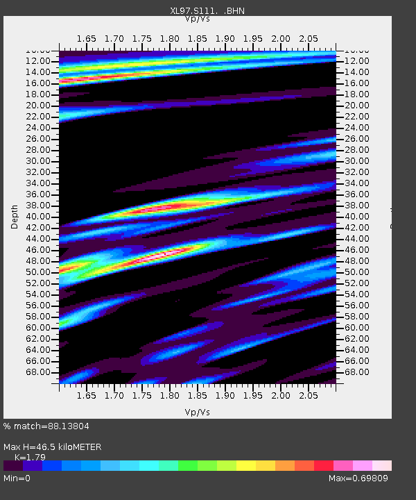
| Arrivals | |
| Ps | 6.1 SECOND |
| PpPs | 20 SECOND |
| PsPs/PpSs | 26 SECOND |

