
S201 Cokeville - Earthquake Result Viewer
| ||||||||||||||||||
| ||||||||||||||||||
| ||||||||||||||||||
|
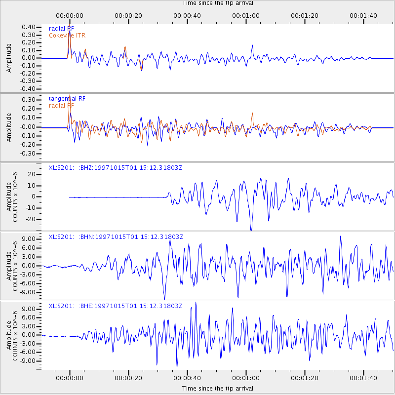
Signal To Noise
| Channel | StoN | STA | LTA |
| XL:S201: :BHN:19971015T01:15:12.31803Z | 1.9891948 | 3.0456002E-7 | 1.5310718E-7 |
| XL:S201: :BHE:19971015T01:15:12.31803Z | 2.0755339 | 4.7683477E-7 | 2.2974078E-7 |
| XL:S201: :BHZ:19971015T01:15:12.31803Z | 13.274737 | 1.6064179E-6 | 1.2101314E-7 |
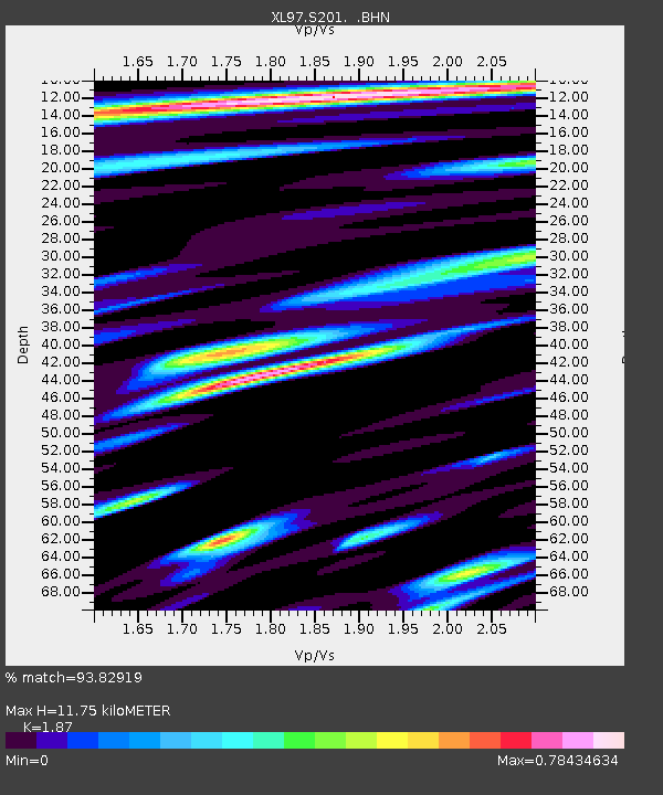
| Arrivals | |
| Ps | 1.7 SECOND |
| PpPs | 5.3 SECOND |
| PsPs/PpSs | 7.0 SECOND |

