
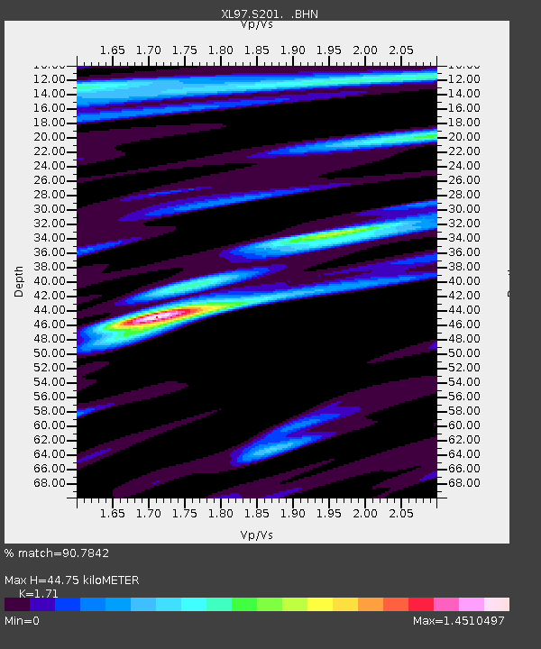
S201 Cokeville - Earthquake Result Viewer
| ||||||||||||||||||
| ||||||||||||||||||
| ||||||||||||||||||
|
Signal To Noise
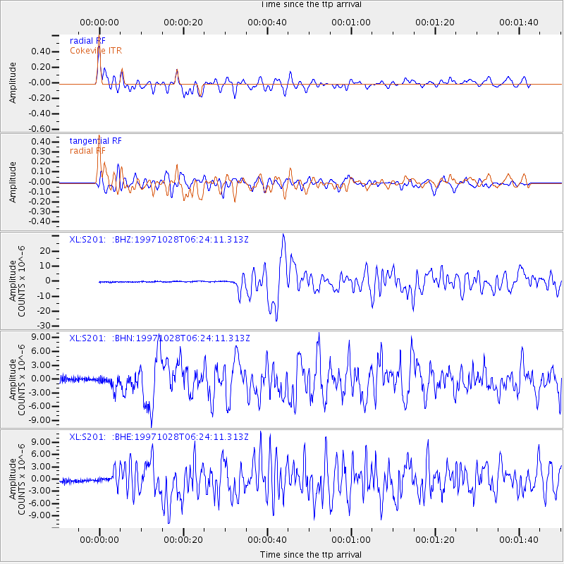
| Channel | StoN | STA | LTA |
| XL:S201: :BHN:19971028T06:24:11.313Z | 2.5040298 | 1.5298352E-6 | 6.109493E-7 |
| XL:S201: :BHE:19971028T06:24:11.313Z | 1.3648027 | 1.5268167E-6 | 1.1187087E-6 |
| XL:S201: :BHZ:19971028T06:24:11.313Z | 15.493691 | 4.2884803E-6 | 2.767888E-7 |
| Arrivals | |
| Ps | 5.4 SECOND |
| PpPs | 19 SECOND |
| PsPs/PpSs | 24 SECOND |

