You are here: Home > Network List > IC - New China Digital Seismograph Network Stations List
> Station HIA Hailar, Neimenggu Autonomous Region, China > Earthquake Result Viewer
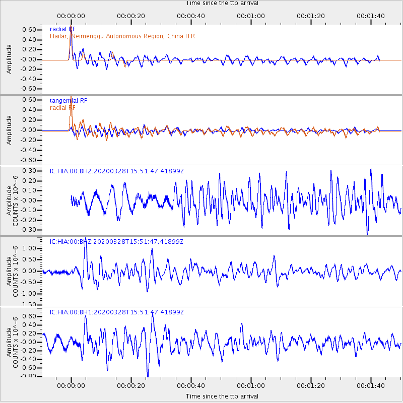
HIA Hailar, Neimenggu Autonomous Region, China - Earthquake Result Viewer
*The percent match for this event was below the threshold and hence no stack was calculated.
| Earthquake location: |
Sulawesi, Indonesia |
| Earthquake latitude/longitude: |
-1.8/120.2 |
| Earthquake time(UTC): |
2020/03/28 (088) 15:43:17 GMT |
| Earthquake Depth: |
10 km |
| Earthquake Magnitude: |
5.8 Mww |
| Earthquake Catalog/Contributor: |
NEIC PDE/us |
|
| Network: |
IC New China Digital Seismograph Network |
| Station: |
HIA Hailar, Neimenggu Autonomous Region, China |
| Lat/Lon: |
49.27 N/119.74 E |
| Elevation: |
620 m |
|
| Distance: |
50.8 deg |
| Az: |
359.624 deg |
| Baz: |
179.426 deg |
| Ray Param: |
$rayparam |
*The percent match for this event was below the threshold and hence was not used in the summary stack. |
|
| Radial Match: |
78.6909 % |
| Radial Bump: |
400 |
| Transverse Match: |
60.240963 % |
| Transverse Bump: |
400 |
| SOD ConfigId: |
20906531 |
| Insert Time: |
2020-04-11 15:46:22.928 +0000 |
| GWidth: |
2.5 |
| Max Bumps: |
400 |
| Tol: |
0.001 |
|
Signal To Noise
| Channel | StoN | STA | LTA |
| IC:HIA:00:BHZ:20200328T15:51:47.41899Z | 4.9523973 | 4.563774E-7 | 9.2152824E-8 |
| IC:HIA:00:BH1:20200328T15:51:47.41899Z | 2.3423913 | 2.132104E-7 | 9.102254E-8 |
| IC:HIA:00:BH2:20200328T15:51:47.41899Z | 0.7355847 | 6.2518886E-8 | 8.4992095E-8 |
| Arrivals |
| Ps | |
| PpPs | |
| PsPs/PpSs | |


