You are here: Home > Network List > KN - Kyrgyz Seismic Telemetry Network Stations List
> Station TKM KN.TKM > Earthquake Result Viewer
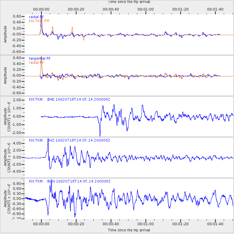
TKM KN.TKM - Earthquake Result Viewer

| Earthquake location: |
Off East Coast Of Honshu, Japan |
| Earthquake latitude/longitude: |
39.5/143.0 |
| Earthquake time(UTC): |
1992/07/18 (200) 13:56:53 GMT |
| Earthquake Depth: |
21 km |
| Earthquake Magnitude: |
5.7 MB, 6.0 MS |
| Earthquake Catalog/Contributor: |
WHDF/NEIC |
|
| Network: |
KN Kyrgyz Seismic Telemetry Network |
| Station: |
TKM KN.TKM |
| Lat/Lon: |
42.86 N/75.32 E |
| Elevation: |
960 m |
|
| Distance: |
49.8 deg |
| Az: |
297.095 deg |
| Baz: |
69.592 deg |
| Ray Param: |
0.068419635 |
| Estimated Moho Depth: |
40.0 km |
| Estimated Crust Vp/Vs: |
1.96 |
| Assumed Crust Vp: |
6.306 km/s |
| Estimated Crust Vs: |
3.226 km/s |
| Estimated Crust Poisson's Ratio: |
0.32 |
|
| Radial Match: |
96.10383 % |
| Radial Bump: |
355 |
| Transverse Match: |
92.54836 % |
| Transverse Bump: |
400 |
| SOD ConfigId: |
4480 |
| Insert Time: |
2010-03-08 20:46:39.190 +0000 |
| GWidth: |
2.5 |
| Max Bumps: |
400 |
| Tol: |
0.001 |
|
Signal To Noise
| Channel | StoN | STA | LTA |
| KN:TKM: :BHZ:19920718T14:05:14.200006Z | 24.480227 | 1.5971146E-6 | 6.524101E-8 |
| KN:TKM: :BHN:19920718T14:05:14.200006Z | 9.921487 | 3.369889E-7 | 3.3965566E-8 |
| KN:TKM: :BHE:19920718T14:05:14.200006Z | 16.738405 | 6.8901187E-7 | 4.116353E-8 |
| Arrivals |
| Ps | 6.4 SECOND |
| PpPs | 18 SECOND |
| PsPs/PpSs | 24 SECOND |


