TKM KN.TKM - Earthquake Result Viewer
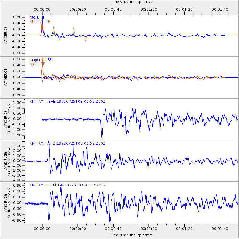
Earthquake location: Off East Coast Of Honshu, Japan
Earthquake latitude/longitude: 38.6/143.0
Earthquake time(UTC): 1992/07/25 (207) 02:53:29 GMT
Earthquake Depth: 29 km
Earthquake Magnitude: 5.9 MB, 5.6 MS, 5.4 UNKNOWN
Earthquake Catalog/Contributor: WHDF/NEIC
Network: KN Kyrgyz Seismic Telemetry Network
Station: TKM KN.TKM
Lat/Lon: 42.86 N/75.32 E
Elevation: 960 m
Distance: 50.2 deg
Az: 297.7 deg
Baz: 70.542 deg
Ray Param: 0.06815911
Estimated Moho Depth: 33.5 km
Estimated Crust Vp/Vs: 2.10
Assumed Crust Vp: 6.306 km/s
Estimated Crust Vs: 3.006 km/s
Estimated Crust Poisson's Ratio: 0.35
Radial Match: 97.76951 %
Radial Bump: 261
Transverse Match: 90.49763 %
Transverse Bump: 400
SOD ConfigId: 4480
Insert Time: 2010-03-08 20:46:41.336 +0000
GWidth: 2.5
Max Bumps: 400
Tol: 0.001

Signal To Noise

ChannelStoNSTALTA
KN:TKM: :BHZ:19920725T03:01:52.200Z42.8778571.4822535E-63.4569208E-8
KN:TKM: :BHN:19920725T03:01:52.200Z9.660613.2376585E-73.3514013E-8
KN:TKM: :BHE:19920725T03:01:52.200Z15.8175686.4188134E-74.058028E-8
Arrivals
Ps6.1 SECOND
PpPs16 SECOND
PsPs/PpSs22 SECOND