TKM KN.TKM - Earthquake Result Viewer
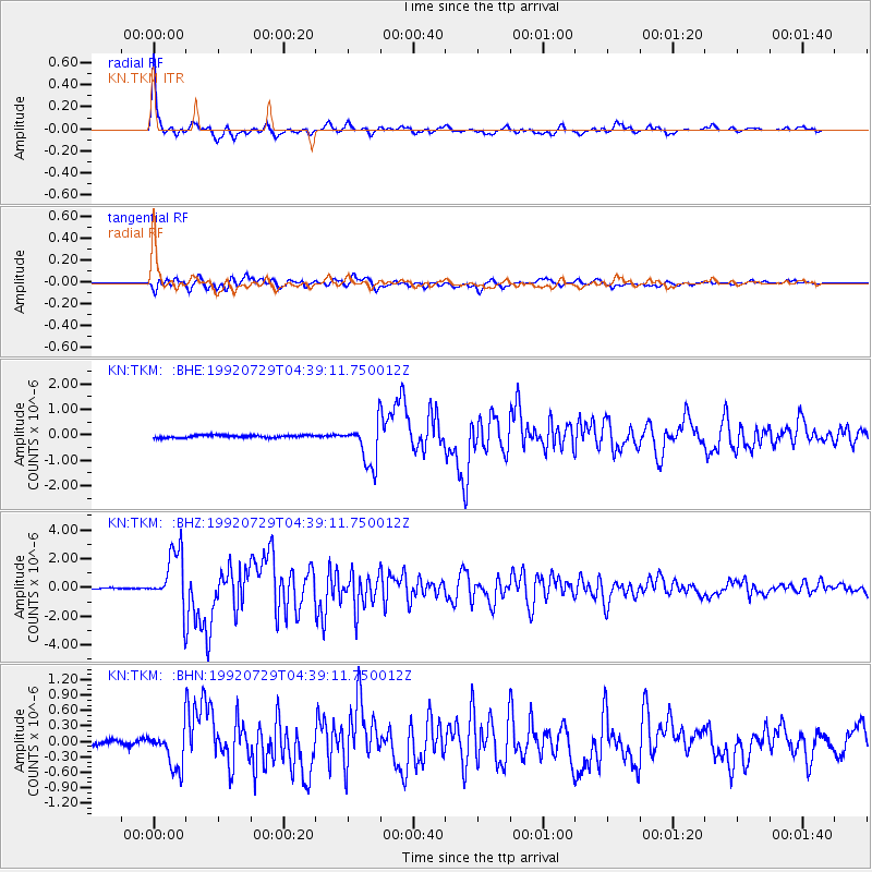
Earthquake location: Off East Coast Of Honshu, Japan
Earthquake latitude/longitude: 39.4/143.5
Earthquake time(UTC): 1992/07/29 (211) 04:30:49 GMT
Earthquake Depth: 29 km
Earthquake Magnitude: 5.9 MB, 6.1 MS, 6.1 UNKNOWN
Earthquake Catalog/Contributor: WHDF/NEIC
Network: KN Kyrgyz Seismic Telemetry Network
Station: TKM KN.TKM
Lat/Lon: 42.86 N/75.32 E
Elevation: 960 m
Distance: 50.2 deg
Az: 297.287 deg
Baz: 69.387 deg
Ray Param: 0.06816319
Estimated Moho Depth: 38.25 km
Estimated Crust Vp/Vs: 2.04
Assumed Crust Vp: 6.306 km/s
Estimated Crust Vs: 3.087 km/s
Estimated Crust Poisson's Ratio: 0.34
Radial Match: 97.66033 %
Radial Bump: 328
Transverse Match: 89.495476 %
Transverse Bump: 400
SOD ConfigId: 4480
Insert Time: 2010-03-08 20:46:42.620 +0000
GWidth: 2.5
Max Bumps: 400
Tol: 0.001

Signal To Noise

ChannelStoNSTALTA
KN:TKM: :BHZ:19920729T04:39:11.750012Z52.3907971.9735924E-63.7670596E-8
KN:TKM: :BHN:19920729T04:39:11.750012Z5.92507363.7078036E-76.257819E-8
KN:TKM: :BHE:19920729T04:39:11.750012Z16.2181688.3939057E-75.175619E-8
Arrivals
Ps6.6 SECOND
PpPs18 SECOND
PsPs/PpSs24 SECOND