TKM KN.TKM - Earthquake Result Viewer
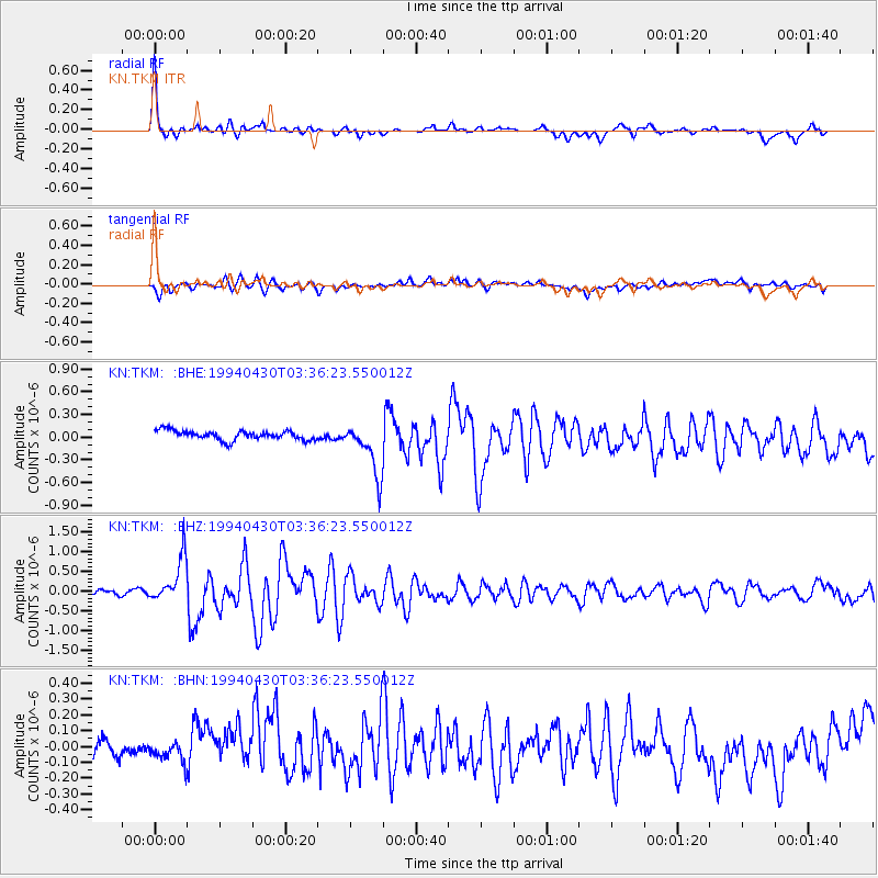
Earthquake location: Kyushu, Japan
Earthquake latitude/longitude: 31.3/131.2
Earthquake time(UTC): 1994/04/30 (120) 03:28:39 GMT
Earthquake Depth: 30 km
Earthquake Magnitude: 5.6 MB, 5.3 MS, 5.1 UNKNOWN, 5.8 MW
Earthquake Catalog/Contributor: WHDF/NEIC
Network: KN Kyrgyz Seismic Telemetry Network
Station: TKM KN.TKM
Lat/Lon: 42.86 N/75.32 E
Elevation: 960 m
Distance: 45.3 deg
Az: 301.063 deg
Baz: 85.535 deg
Ray Param: 0.07130507
Estimated Moho Depth: 35.25 km
Estimated Crust Vp/Vs: 2.10
Assumed Crust Vp: 6.306 km/s
Estimated Crust Vs: 3.006 km/s
Estimated Crust Poisson's Ratio: 0.35
Radial Match: 90.74953 %
Radial Bump: 334
Transverse Match: 60.90051 %
Transverse Bump: 400
SOD ConfigId: 4480
Insert Time: 2010-03-08 20:46:50.687 +0000
GWidth: 2.5
Max Bumps: 400
Tol: 0.001

Signal To Noise

ChannelStoNSTALTA
KN:TKM: :BHZ:19940430T03:36:23.550012Z9.7155545.711504E-75.878722E-8
KN:TKM: :BHN:19940430T03:36:23.550012Z0.69246846.3879725E-89.224931E-8
KN:TKM: :BHE:19940430T03:36:23.550012Z5.70023973.4984168E-76.137315E-8
Arrivals
Ps6.5 SECOND
PpPs16 SECOND
PsPs/PpSs23 SECOND