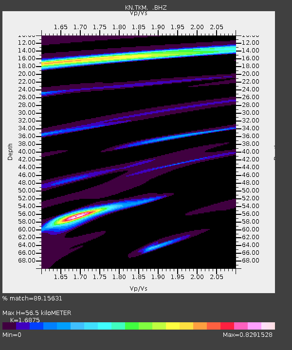
TKM KN.TKM - Earthquake Result Viewer
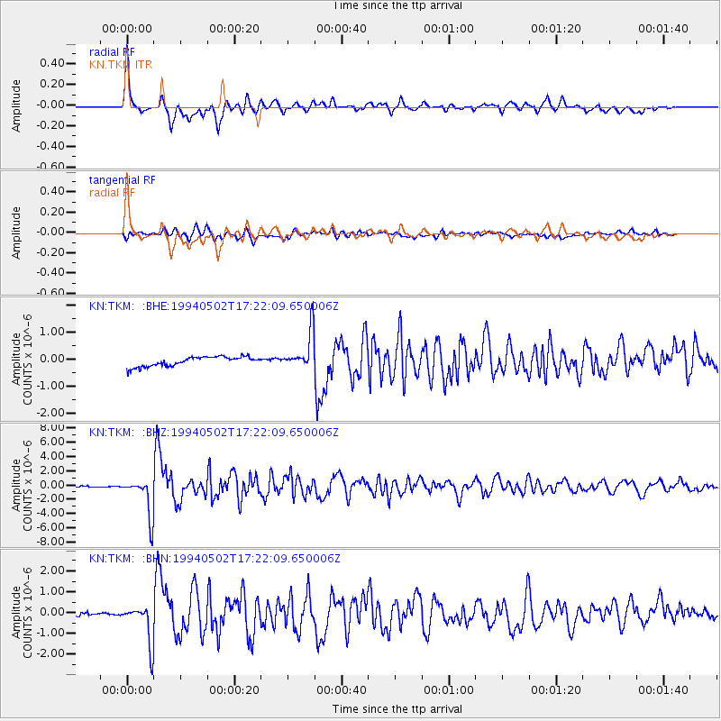
Earthquake location: Southwest Of Sumatra, Indonesia
Earthquake latitude/longitude: -1.1/97.6
Earthquake time(UTC): 1994/05/02 (122) 17:14:03 GMT
Earthquake Depth: 38 km
Earthquake Magnitude: 6.1 MB, 5.8 MS, 5.6 UNKNOWN, 6.0 MW
Earthquake Catalog/Contributor: WHDF/NEIC
Network: KN Kyrgyz Seismic Telemetry Network
Station: TKM KN.TKM
Lat/Lon: 42.86 N/75.32 E
Elevation: 960 m
Distance: 48.2 deg
Az: 338.012 deg
Baz: 149.396 deg
Ray Param: 0.069463395
Estimated Moho Depth: 56.5 km
Estimated Crust Vp/Vs: 1.69
Assumed Crust Vp: 6.306 km/s
Estimated Crust Vs: 3.737 km/s
Estimated Crust Poisson's Ratio: 0.23
Radial Match: 89.15631 %
Radial Bump: 400
Transverse Match: 82.49484 %
Transverse Bump: 400
SOD ConfigId: 4480
Insert Time: 2010-03-08 20:46:51.688 +0000
GWidth: 2.5
Max Bumps: 400
Tol: 0.001

Signal To Noise

ChannelStoNSTALTA
KN:TKM: :BHZ:19940502T17:22:09.650006Z27.1972682.787407E-61.024885E-7
KN:TKM: :BHN:19940502T17:22:09.650006Z3.0284269.792474E-73.233519E-7
KN:TKM: :BHE:19940502T17:22:09.650006Z4.09393647.218747E-71.7632777E-7
Arrivals
Ps6.5 SECOND
PpPs23 SECOND
PsPs/PpSs29 SECOND